Hotan (Hetian) Travel Guide
Hotan Facts
Chinese Name: 和田 (hé tián)
Population: 2,324,300
Area: 248,100 square kilometers (95,792 square miles)
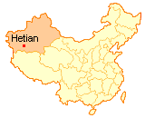
Location: in the south of Xinjiang, northwest China
Administrative Division: 1 county-level city (Hetian); 7 counties (Hetian, Pishan, Moyu, Luopu, Cele, Yutian, Minfeng)
Area Code: 0903
Zip Code: 848000
GDP (2018): CNY 30.557 billion (USD 4.618 billion)
Nationalities: Uygur, Han, Hui, Kazak, Kirgiz
Famous for Producing Hetian Nephrite Jade
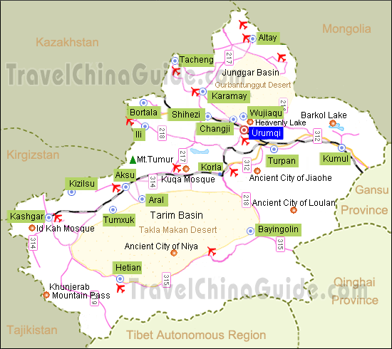
Located at the northern foot of the Karakorgan Range and on the southern fringe of the Taxkorgan Desert, Hotan is an oasis lying in the Tarim Basin, neighboring to Bayingolin to the east, Aksu to the north, Kashgar to the west, and Jammu and Kashmir to the southwest. Hotan is a historic city where a brilliant ancient civilization including the Kunlun mythology was created. The mythology influenced by Taoism mainly records a series of stories about the gods, goddesses of ancient China.
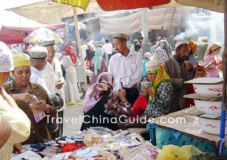
Hetian is also the main producing area of Hetian jade, one of four high-quality jade in China. Hetian jade was used as ornaments or sacrificial utensils for the royal family. Confucianism also endows virtue to Hotan jade, thereby it was favored by gentlemen in ancient China. Tourists can go to Hotan bazaar to purchase special tourism products such as Hotan Jade, silk and carpet, and taste local snacks.![]() Pictures
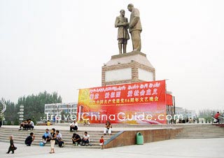
Pictures
As a bustling center on the southern stretch of the ancient Silk Road, Hotan was one of the three thriving commercial centers in the history of Xinjiang. The ruins of many historical cultural sites still stand in desert in today's 'silk capital' Hotan, as a reminder of their brilliant past. In the main these are: Ancient City of Niya, Ancient City of Mallikurwatur, Ancient City of Yoktan. The Hetian Museum has a fine collection of cultural relics.![]() Other Scenic Spots: Kunlun Mountains, Muz Mountain of Cele (Qira) County, Hotan Oasis
Other Scenic Spots: Kunlun Mountains, Muz Mountain of Cele (Qira) County, Hotan Oasis
|
|
How to Get to Hotan
1. Hotan Airport is located about 11.5km (7 mi) south of the city downtown area. It has 6 daily flights to Urumqi and other direct flights to Beijing, Chengdu, Chongqing, Guangzhou, Xi'an, Tianjin, Zhengzhou, Aksu, Kashgar and Yining. Airport shuttle bus is available to Hotan Railway Station.
2. There is a daily train service from the Railway Station to Urumqi.
3. This area is served by China National Highway 315, which runs along the southern Tarim Basin from Ruoqiang to Kashgar, and the Trans-Taklamakan Desert Highway, which run north to Aksu. There are regular buses running daily to Yining, Kashgar, Aksu, Kolar, Turpan, Wushentala, etc.
4. There are ten public bus lines traveling around the city. Passengers can take them easily to the passenger distributed centers.
5. The taxi fares in the city are CNY5 (Daytime)/CNY7 (Nighttime) for the first three kilometers and then CNY1.3 per additional kilometer.
6. Since most attractions in the city lie in the desert, car rental is the best option for travel to them. A cross country Jeep is recommended in view of the nature of the terrain.
7. Hotan Yutian Airport will start to build in 2019 or 2020. Around 13 kilometers (8 miles) away from downtown area, Hotan Yutian Airport is located in Yutian County, Hotan City of Xinjiang Uygur Autonomous Region.
Weather
Located in the warm temperature zone, the area is dominated by a dry continental desert climate. It is hot in summer and not too cold in winter. The temperature has a great disparity between day and night. There are about 182~226 frost-free days a year. It has little rainfall and a high evaporation rate with an annual rainfall of 28.9 to 47.1 mm. The average annual temperature is from 11-12.1 ![]() C (51.8-53.8
C (51.8-53.8![]() F) with an average sunshine time of 2470.4 to 2875.9 hours annually. August to September is the best period for visiting the area due to the beautiful scenery and nice weather.
F) with an average sunshine time of 2470.4 to 2875.9 hours annually. August to September is the best period for visiting the area due to the beautiful scenery and nice weather.
Hotan Travel Tips
![]() Physical Features: The hypsography slopes down from south to north in this area with Karakorgan Mountains to the south and Taxkorgan Desert to the north. It has an elevation of 1,372 meters.
Physical Features: The hypsography slopes down from south to north in this area with Karakorgan Mountains to the south and Taxkorgan Desert to the north. It has an elevation of 1,372 meters.![]() History: Hotan was where the states of Pishan, Yutian, Yumi, Qule, Jingjue and Shulu were established. Since 60BC during the West Han Dynasty, it has been recognized as Chinese territory. In 1883, this place was established as a prefecture to be supervised directly by the court, while in 1920, it became a prefecture. In history, this place was a town of military importance along the ancient Silk Road. It was also the crux of the four most important civilizations in the ancient world.
History: Hotan was where the states of Pishan, Yutian, Yumi, Qule, Jingjue and Shulu were established. Since 60BC during the West Han Dynasty, it has been recognized as Chinese territory. In 1883, this place was established as a prefecture to be supervised directly by the court, while in 1920, it became a prefecture. In history, this place was a town of military importance along the ancient Silk Road. It was also the crux of the four most important civilizations in the ancient world.![]() Local Highlights: Corban, Roza, Jade Cultural Festival, Yutian Music Dancing
Local Highlights: Corban, Roza, Jade Cultural Festival, Yutian Music Dancing![]() Local Products: jade, sheep, silk, carpet, Uighur medicine medicine, gelatin, pomegranates, yams, apricots
Local Products: jade, sheep, silk, carpet, Uighur medicine medicine, gelatin, pomegranates, yams, apricots
Thanks in advance
Thanks in advance
3 trains depart from Hotan at 14:39 15:24 16:05 and it takes about 22-26h to Urumqi. The train tickets costs CNY217-585.
Many thanks:)
Alison
The market is in Taibei road (台北路).