Wuhan Map
Wuhan Map
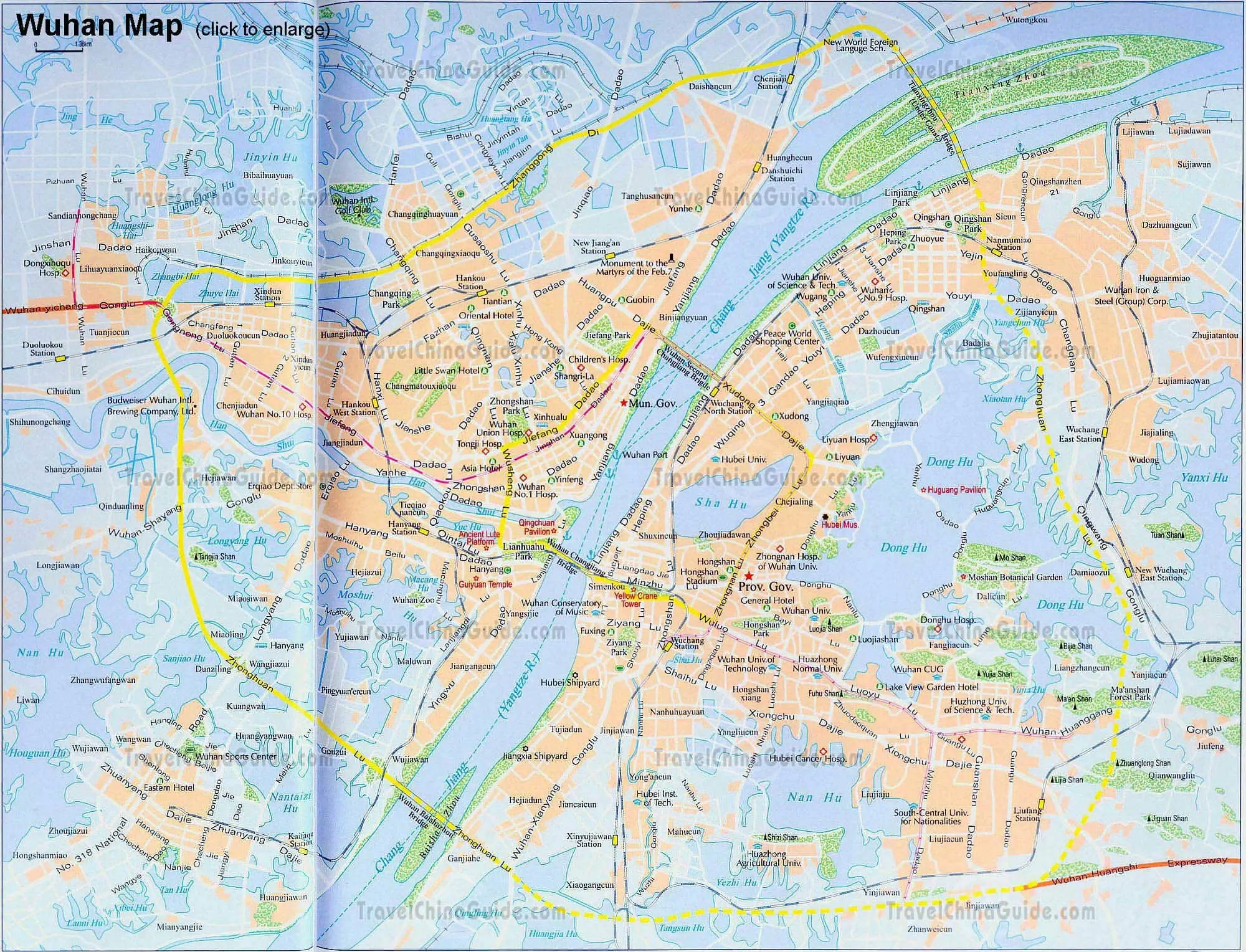
Wuhan is located in the east of the Jianghan Plain and at the junction of the Yangtze River and the Hanshui River. It is made up of Wuchang, Hankou and Hanyang, namely the Three Towns of Wuhan that is often mentioned. Seeing this map of the city, you find it boasts many lakes. Among those, Donghu (East Lake) is the largest. Besides, you can see the major attraction sights in downtown, which are written in red, including Hubei Museum, Yellow Crane Tower, Guiyuan Temple, Qingchuan Pavilion, Ancient Lute Platform and the Huguang Pavilion by the East Lake. Also the major hotels, hospitals, universities, railway stations are shown in the map clearly. Leaving for other cities, you may go to Wuchang or Hankou railway station to take a train.
Wuhan Metro Maps


Wuhan Attraction Maps
- Last updated on Nov. 07, 2019 -
Questions & Answers on Wuhan Map
Asked by Ben from AUSTRALIA | Jun. 08, 2018 05:56 Reply
Reply
How to get taxi from Wuhan airport to optics valley plaza?
And normally how much would it cost?
Answers (2)
Answered by Jessica from USA | Jun. 11, 2018 02:12 1
1 0Reply
In fact, there are many taxis in the airport you can call one easily. The fare is about CNY130.
You can also take the Metro Line 2 from the airport directly to optics valley plaza. Get out of the Exit E and walk about 300m to get there.
You can also take the Metro Line 2 from the airport directly to optics valley plaza. Get out of the Exit E and walk about 300m to get there.
Answered by Ben from AUSTRALIA | Jun. 11, 2018 05:0900Reply
Thanks Jessica