China Highway Map
China Highway Map
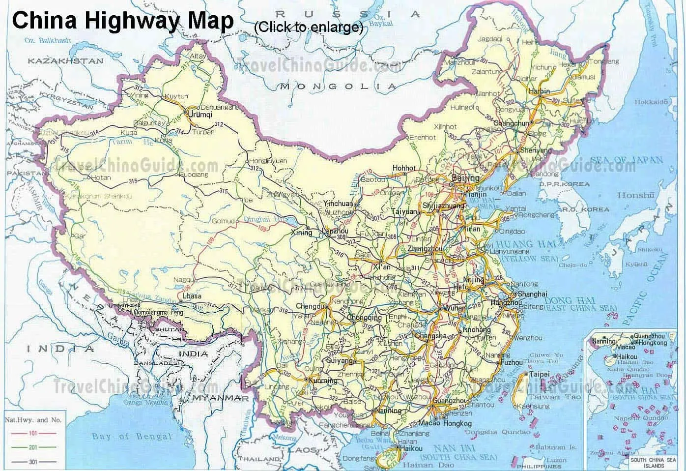
- Last updated on Mar. 10, 2021 -
Questions & Answers on China Highway Map
Asked by Phang Agus from INDONESIANA | Apr. 04, 2015 04:31 Reply
Reply
Which airport do you recommend?
We will go to Pingtan and Anhui and Henan, from Jakarta, Which Airport and the nearest would you recommend us to arrived first ( Guangzhou, Beijing, Shanghai, Hangzhou ) and from those Airport how far use Plane and use High Speed Train ?
Thanks
Thanks
Answers (1)
Answered by Abbey from IRELAND | Apr. 09, 2015 03:37 0
0 2Reply
Did you mean Pingtan in Fujian Province? If so, I think you may fly to Xiaoshan International Airport in Hangzhou if there is a flight from your country. You can take high speed train from Hangzhou East Railway Station to Fuzhou first. It takes around 5 hours and 15 minutes. After you arrive in Fuzhou, you can go to Fuzhou South Bus Station to Ping Tan. It costs around CNY 50 for the bus fare.
And it's easy for you to fly or take train from Hangzhu to Henan and Anhui.
And it's easy for you to fly or take train from Hangzhu to Henan and Anhui.