Yarlung Tsangpo River Pictures
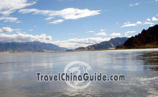
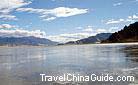
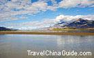
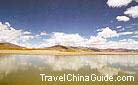
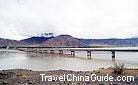
Yarlung Tsangpo is the largest river in Tibet with broad river valley and slight inclination of river bed.
Rising in the Gyaimanezong Glacier on the north side of the Himalayas, Yarlung Tsangpo is an international water system, flowing about 2,900 kilometers from southern margin of Tibet Plateau, via India and finally into the Indian Ocean at the Bengal Bay. Along the route, vegetation and landscape varies greatly as the fall descents, making up one of the highest and challenging river across the world. Attraction Intro: Yarlung Tsangpo River
1 of 5 photos
- Last modified on Dec. 13, 2017 -
Questions & Answers on Yarlung Tsangpo River Pictures
Asked by Mrs.Sandra from CANADA | Aug. 16, 2009 18:01 Reply
Reply
Hi, we want to travel from Beijing to Xi'an, then Chengu and final destination Lhasa. We are currently working with a travel agent to book an organized trip for Tibet for early September.
The question we have is about access to electricity on the trains. Does this train have electricity for laptops, etc? Is it only available to their passengers in First Class or Business Class.? Also, what kind of circuits they have so we can bring the proper plugs, etc.
As it is the busy season, would you recommend to book now?
Thanks a lot.
Sandra
Answers (1)
Answered by Ms.Lyla from US | Aug. 17, 2009 03:04 0
0 0Reply
Most of the soft sleeper cabins have the plugs. But voltage may not be so stable. It is better you do not use you laptop on the train. If you want to travel buy train, ask your travel agency to buy the tickets asap. as it is the summer holiday and college students are about to back to school.
Asked by Mrs.Millar from UK | Jul. 27, 2009 08:57Reply
Dear Sir/Madam,
we are currently organizing our group tour in Tibet but have not finalized it yet with the travel agency (It depends which of the two will be cheaper for our itinerary). However, in order to have a chance of buying train tickets to Lhasa when they go on sale ten days before departure we need to go to the railway station and buy them within the next days. Do we need the special Permit already when buying the ticket or only when boarding the train?
Does one get the health card at the Beijing railway station or somewhere else?
With many thanks
Sandy Millar
Answers (1)
Answered by Mr.ciny from CN | Jul. 27, 2009 20:4600Reply
Hi, dear, you must follow a travel agency, as it is not allowed to visit the holy place individually. If you follow a travel agency, and there is no need to worry about the tickets, they will arrange everything! I am sorry that i can not understand your second question.