Baotou Travel Guide
Baotou Facts
Chinese Name: 包头 (bāo tóu)
Population: 2,889,000
Area: 27,768 square kilometers (10,721 square miles)
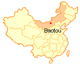
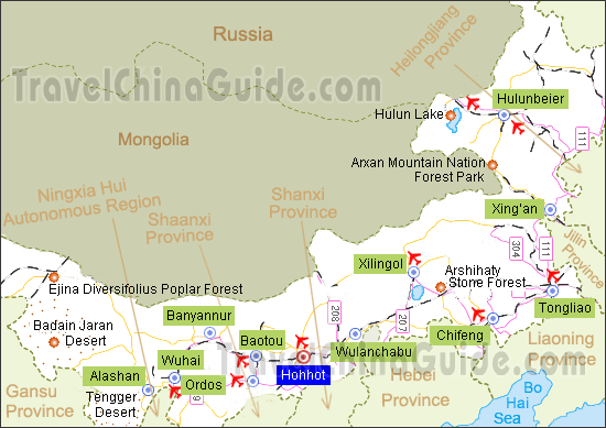
Location: in the west of Inner Mongolia, north China
Administrative Division: 5 districts (Kundulun, Qingshan, Donghe, Jiuyuan, Shiguai); 1 county (Guyang); 2 banners (Tumute Left Banner, Daerhan Ming’an Joint Banner)
Area Code: 0472
Zip Code: 014000
GDP (2018): CNY 295.18 billion (USD 44.61 billion)
Nationalities: Han, Mongol, Hui, Man, Chaoxian
City of Steel in Gobi
Baotou is located at the foot of the Yinshan Mountains, and on the bank of the Yellow River. The word Baotou is Mongolian, meaning the 'place where deer live'. Hence it is also called the Deer City. Baotou covers the largest green area in Inner Mongolia. It is also the largest industrial city in Inner Mongolia with metallurgy, rare earth and machinery industries as its main industries. Baotou's unique geographical location provided convenience for many ancient Mongolian and Shanxi businessmen to do business here, contributing to the exchanges and integration of the nomadic culture and the northern Chinese culture. In today's Baotou, no matter diet culture or living habits, one can feel the unique Chinese northwest customs. Summer and autumn (from late June to early September) are definitely the best time to visit Baotou when this city becomes an ideal summer resort with the cool wind, colorful flowers, abundant fruits and vegetables.
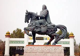
Visit the Mongolian yurts, drink a bowl of warm milk tea, and enjoy eating mutton with your hands, which are all indispensable ways to experience the Mongolian customs in Baotou. Saihan Tala Grassland is the only grassland in China that is located in a city center. Some 100 kilometers away in Ordos's desert, the Genghis Khan' Mausoleum is also a must for visitors as it is not too far away.
|
|
Located at the Kubuqi Desert of Inner Mongolia, Singing Sand Ravine is a good choice for those who would like to relax themselves in a desert. The International Photography Week is annually held in mid July here.
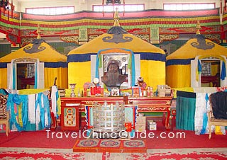
Wudangzhao Lamasery lies around 70km (43mi) northeast of Baotou. Wudang means “willow” and Zhao means “monastery / temple”in Mongolian. The main buildings in Wudangzhao Monastery include three living Buddha residences and a funeral hall where the relics of a couple of living Buddhas are preserved.
More Attractions in Baotou: Xilamuren Grassland
Weather
2. Special line car: Located in Donghe District, Baotou East Station has direct bus between these two places; 2 times a day and the journey is about 2 hours;
3. Coach: Take the bus in Coach Station (No.3, Zhanbei West Road) to Shiguai, then taxi to your destination.