Ngari (Ali) Travel Guide
Ngari Facts
Chinese Name: 阿里 (ā lǐ)
Population: 124,000
Area: 345,000 square kilometers (133,205 square miles)
Location: in the west of Tibet, southwest China
Administrative Division: 7 counties (Gar, Burang, Zada, Rutog, Ge'gyai, Gerze, Coqen)
Area Code: 0897
Zip Code: 859000
GDP (2019): CNY 6.24 billion (USD 0.90 billion)
Nationalities: Tibetan, Han, Hui
A Mountainous China’s Least Densely Populated Area
Ngari (Ali) stands in western Tibet Autonomous Region, southwest frontier of China. It neighbors Xinjiang to the north and Shigatse and Nachu to the east. Furthermore, it has a total frontier of 1,116 kilometers (693 miles) bordering upon India and Nepal in the south and Kashmir to the west.
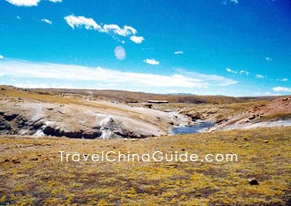
Ngari is one of the least densely populated areas in the world. From the 10th century to the early 17th century, prosperous and powerful Guge Kingdom ruled here and promoted Buddhism, leaving many exquisite religious art works including wall paintings, sculptures and stone carvings. It built the first Buddhist temple in Ngari - Tholing Monastery. More than 300 caves and houses relics built in the mountains can be seen in the Ruins of Guge Kingdom. Besides, there are many mountain ranges in the territory, including the Himalayas and the Gangdese Mountains. The Mount Kailash is lionized by many religious denominations. The beautiful Lake Manasarova, Pangong Tso Lake and Lake Rakshastal also deserve a visit.
![]() Tholing Monastery was a famous Buddhist temple in Tibet built in the 11th Century by the prince of Guge Kingdom. In 1042, an Indian dignitary once gave sutra lectures here, greatly promoting the development of the Buddhism in Ngari. The monastery is also a witness of the renaissance of the area's Buddhism. Over one thousand deer antlers, pictographs and hieroglyphics collected in the temple are of great archeological value.
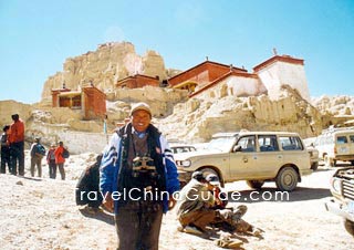
Tholing Monastery was a famous Buddhist temple in Tibet built in the 11th Century by the prince of Guge Kingdom. In 1042, an Indian dignitary once gave sutra lectures here, greatly promoting the development of the Buddhism in Ngari. The monastery is also a witness of the renaissance of the area's Buddhism. Over one thousand deer antlers, pictographs and hieroglyphics collected in the temple are of great archeological value.![]() Ruins of Guge Kingdom was constructed on a mountain 18 kilometers (11 miles) west of Zada (Zhada) County. During the 10th Century to 17th Century, Guge Kingdom created a brilliant history. Hundreds of rooms and caves are built on the mountain 300 meters (984 feet) above the mountain foot. After its national destruction, frescos in temples on the mountainside about Sakyamuni, the king and queen of the Guge are the most precious treasure the lost kingdom left behind.
Ruins of Guge Kingdom was constructed on a mountain 18 kilometers (11 miles) west of Zada (Zhada) County. During the 10th Century to 17th Century, Guge Kingdom created a brilliant history. Hundreds of rooms and caves are built on the mountain 300 meters (984 feet) above the mountain foot. After its national destruction, frescos in temples on the mountainside about Sakyamuni, the king and queen of the Guge are the most precious treasure the lost kingdom left behind. ![]() Other Scenic Spots:
Other Scenic Spots:
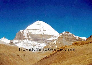
Mount Kailash and Lake Manasarova: They are considered as the 'Sacred Mountain' and 'Holy Lake' by Hinduism, Buddhism, Jainism and Bon both located in Burang or Pulan County.
Pangong Tso Lake at Rutog County; Lake Rakshastal: sisiter lake of Lake Manasarova.
Due to the 'Sacred Mountain' and 'Holy Lake', Burang is drawing increasingly more attention of visitors. It is about 400 kilometers (249 miles) from Shiquanhe Town, and only 20 kilometers (12 miles) from Sino-Nepal boundary in neighborhood of India. Pilgrims and peddlers often choose this port entering Tibet.
Two routes to Burang County:
1. southward from Urumqi along the Xinjiang-Tibet Road, passing Yecheng and Shiquanhe and finally arriving in Burang, whole course of 3,044 kilometers (1,891 miles)
2. westward from Lhasa passing Shigatse and Saga to Burang, whole course of 1,433 kilometers (890 miles)
See more: Burang Attractions, Hiking Mountain Kailash, Lake Manasarovar Pilgrimage
|
|
How to Get to Ngari
![]() Ngari Gunsa Airport
Ngari Gunsa Airport
It is the fourth airport constructed in Tibet, located in the southwest of Shiquanhe Town, Ngari Region. With an altitude of 4,274 meters, this airport mainly operates an airway from Chengdu to Ngari via Lhasa at present. The 1,098-kilometers' journey from Lhasa could be finished in 1.5 hours, which takes at least two days by road.
At 05:50 of every Tuesday and Friday, there is a plane of Air China taking off from Chengdu Shuangliu Airport to this airport via Lhasa Gonggar Airport. It will take 4.5 hours for the flight to finish the 2,300-kilometers' journey. Limited by the high altitude of Tibet, every flight could only take 60 passengers at most but 30 people during hot summer. The flight ticket of the day should be purchased at the local designated ticket office. No online ticket-booking service is opened at present.
| Air Routes | Chengdu | Lhasa | Ngari | |||||||||
| Arr. | Dep. | Arr. | Dep. | Arr. | Dep. | |||||||
| Chengdu→Ngari | --- | 05:50 | 07:50 | 08:40 | 10:20 | --- | ||||||
| Ngari→Chendu | 15:40 | --- | 12:50 | 13:40 | --- | 11:10 | ||||||
1. North Route: 1,760 kilometers (1,094 miles)
Lhasa - Shigatse - Lhaz (Lazi) County - Kaga Town - Sangsang Town - 22 Daoban (Road Gang) - northward to Coqen County - Dongcuo (salt lake) - Gerze - Songba (Xiongba) Town - Ge'gyai County - Shiquanhe Town
2. South Route: 1,190 kilometers (739 miles)
Lhasa - Shigatse - Lhaz (Lazi) County - Kaga Town - Sangsang Town - 22 Daoban (Road Gang) - southward to Saga County - Zhongba County - Paryang Town - Dagon Monastery (Dajin Si)
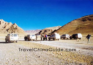
Notable is that the south route is better if going to Kangrinboqe Peak and Lake Manasarovar, and the best time is from May to July for the consideration of road and weather condition. Regular bus can hardly be found from Lhasa to 22 Daoban. The north route is much busier than the south. The latter one is usually chosen by the group tour. Visitors had better rent vehicles in Lhasa and Shigatse. As to those who want to hitch a ride, they should go to Shigatse or Lhaz.
|
|
Weather
Basically, the area enjoys a plateau monsoon climate. In summer, the monsoon from the Indian Ocean may bring precipitation to this area. During winter and spring, gales and strong temperature drop may frequently occur. Its annual average temperature remains around 19![]() C (66.2
C (66.2![]() F). During daytime in August, the temperature is above 10
F). During daytime in August, the temperature is above 10![]() C (50
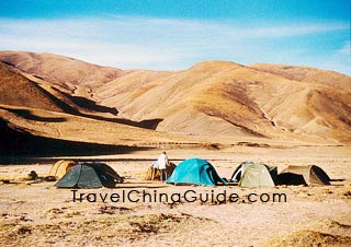
C (50![]() F), but it may drop to the subzero. May to July and September to October are suitable for a visit. Due to the great temperature difference in a day, warm clothes should be the prime priority. The annual rainfall here is extremely slim and mainly happens during July to early September. Road conditions are really awful at that time.
F), but it may drop to the subzero. May to July and September to October are suitable for a visit. Due to the great temperature difference in a day, warm clothes should be the prime priority. The annual rainfall here is extremely slim and mainly happens during July to early September. Road conditions are really awful at that time.
Ngari Travel Tips
![]() History: Before 1949, Ngari was ruled under the feudal serf system, practicing the combination institution of politic and religion and dictatorship of feudal seignior. Chinese People's Liberation Army marched into the region in 1950 and set it free one year later. By 1959, the feudal serf system had been abolished.
History: Before 1949, Ngari was ruled under the feudal serf system, practicing the combination institution of politic and religion and dictatorship of feudal seignior. Chinese People's Liberation Army marched into the region in 1950 and set it free one year later. By 1959, the feudal serf system had been abolished.
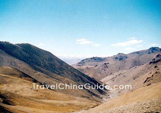
![]() Physical Features: Himalayas, Gangdise Mountains, Kunlun Mountains, Karakoram Mountains and several other arch-shaped mountains lay in order from southern to northern Ngari. They extend northwestward and converge at the Pamirs. Among theses mountain ranges and their branches, strips of mountain valleys and basins are distributed. Therefore, the general terrain of the region declines from north to south.
Physical Features: Himalayas, Gangdise Mountains, Kunlun Mountains, Karakoram Mountains and several other arch-shaped mountains lay in order from southern to northern Ngari. They extend northwestward and converge at the Pamirs. Among theses mountain ranges and their branches, strips of mountain valleys and basins are distributed. Therefore, the general terrain of the region declines from north to south.
![]() Special Local Products: highland barley wine
Special Local Products: highland barley wine
![]() Local Highlights: Where there are religious, there are pilgrimages. Kangrinboqe is considered as a sacred mountain in Hinduism, Buddhism, Jainism and Bon religious. Every year, devotees from Tibetan, India, Nepal and Bhutan will make pilgrimages to the sacred places for blessing following the old traditional way: saluting full body kowtow all the way from afar and moving around and around the sacred mountain.
Local Highlights: Where there are religious, there are pilgrimages. Kangrinboqe is considered as a sacred mountain in Hinduism, Buddhism, Jainism and Bon religious. Every year, devotees from Tibetan, India, Nepal and Bhutan will make pilgrimages to the sacred places for blessing following the old traditional way: saluting full body kowtow all the way from afar and moving around and around the sacred mountain.
|
|