Located in Southeast Asia along the coastline of the Pacific Ocean, China is the world's third largest country, after Russia and Canada. With an area of 9.6 million square kilometers and a coastline of 18,000 kilometers, its shape on the map is like a rooster. It reaches Mohe in Heilongjiang Province as its northern end, Zengmu Ansha (or James Shoal) to the south, Pamirs to the west, and expands to the eastern border at the conjunction of the Heilongjiang (Amur) River and the Wusuli (Ussuri) River, spanning about 50 degrees of latitude and 62 degrees of longitude.
China is bordered by 14 countries -- Korea, Vietnam, Laos, Burma, India, Bhutan, Nepal, Pakistan, Afghanistan, Tajikistan, Kyrgyzstan, Kazakstan, Mongolia, and Russia. Marine-side neighbors include eight countries -- North Korea, Korea, Japan, Philippines, Brunei, Indonesia, Malaysia and Vietnam.
Physical Features
 |
| Pamir Plateau |
The vast land expanses of China include plateaus, plains, basins, foothills, and mountains. Defining rugged plateaus, foothills and mountains as mountainous, they occupy nearly two-thirds of the land, higher in the West and lower in the East like a three-step ladder.
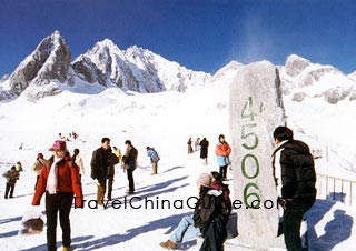
The highest step of the typical 'ladder topography' is formed by the Qinghai-Tibet Plateau at the average height of over 4,000 meters, with the
Kunlunshan range, Qilianshan range and Hengduan mountain chain as the division between this step and the second one. The highest peak in the world, Everest, at 8844.43 meters high is known as 'the Roof of the World'.
On the second step are large basins and plateaus, most of which are 1,000 - 2,000 meters high. The Daxing'an, Taihang, Wu and Xuefeng Mountains divide this step and the next lower one. Plateaus including Inner Mongolian, Loess, Yungui Plateaus, and basins such as Tarim, Junggar, and Sichuan Basins are situated here.
The third step, abundant in broad plains, is dotted with the foothills and lower mountains, with altitudes of over 500 meters. Here are located famous plains: the Northeast, the North China, and the Middle-Lower Yangtze Plains, neighboring with each other from north to south. These well-cultivated and fertile lands produce abundant crops.
Regional Divisions
Although the physical features are as described, people tend to divide China into four regions, that is, the North, South, Northwest and the Qinghai-Tibetan areas. Because of geographical differences, residents of each region have distinctive life styles and customs.
 | | Fertile Plain | |  | | Picturesque Li River | |
The North and South regions are located in the Eastern monsoon area and are divided by the
Qinling Mountains-Huai River. Nearly 95 percent of the Chinese population lives here. The other two regions, the Northwest and Qinghai-Tibetan regions that occupy 55 percent of the land, have fewer people, although most of the ethnic groups cluster there.
Rivers and Lakes
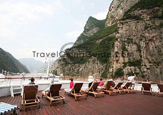
China has numerous rivers and lakes. According to statistics, more than 50,000 rivers have drainage areas that exceed 100 square kilometers; more than 1,500 exceed 1,000 square kilometers. These rivers can also be classified as exterior and interior rivers. The Yangtze, the longest in China and even in Asia, is the third-longest in the world. The Yellow River, 'Mother River of the Chinese People', is just behind the Yangtze, both flowing into the Pacific Ocean. The Yarlung Zangbo River belongs to the Indian Ocean water system, and the Irtysh River to the Arctic Ocean. On the other side, the interior rivers drain less area than the exterior ones.
 | | Yangtze River | | 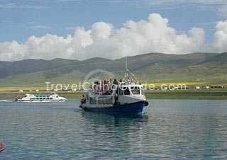 | | Qinghai Lake | |
Lakes are also important. The areas with the most lakes are the Middle-Lower Yangtze Plain and Qinghai-Tibet Plateau. Many lakes in the northwest are salty.
Qinghai Lake, a beautiful natural salt-water lake, is the largest. In southeast China, most lakes are fresh water.
Poyang Lake,
Dongting Lake , and
Taihu Lake are all fresh water lakes.
These provide China with precious resources such as aquatic products, petroleum, natural gas, mines and renewable resources including tide power.
Mountainous Topography
China has large areas of mountainous land, about two-thirds of the country. The ranges mainly run from east to west and from northeast to southwest. Among these mountains, some reach to the sky, and others are lower with charming scenery. Out of the mountains throughout the world at the altitude of over 7,000 meters, over 50 stand in China. To the east in China, lower mountains like
Mt. Taishan,
Mt. Huashan, and
Mt. Emeishan, also display their unique beauty.
 | | Jade Dragon Snow Mountain | | 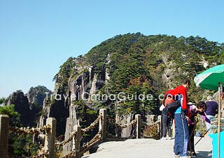 | | Yellow Mountain | |
In addition, they hide rich treasures including botanic, zoologic, and mineral resources.

You may like:
Top 10 Biggest Cities in China by Area
- Last updated on Jun. 01, 2023 -