Hong Kong Maps
Map of Hong Kong
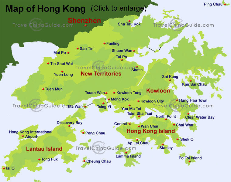
This is a map of Hong Kong SAR of PRC. The city is made up of the New Territories, Kowloon, HK Island and the other over 200 islands. As you can see, the New Territories covers most of the area, adjoining Shenzhen on the north. The well-known locations, such as Central, Tsim Sha Tsui, Mong Kok and Yau Ma Tei, mainly distribute by the Victoria Harbour. The Lantau Island is the biggest outlying island of Hong Kong, where the Hong Kong International Airport is located.
HK Island and Kowloon
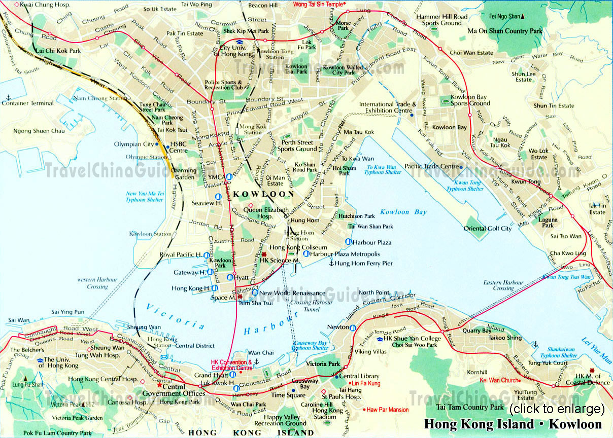
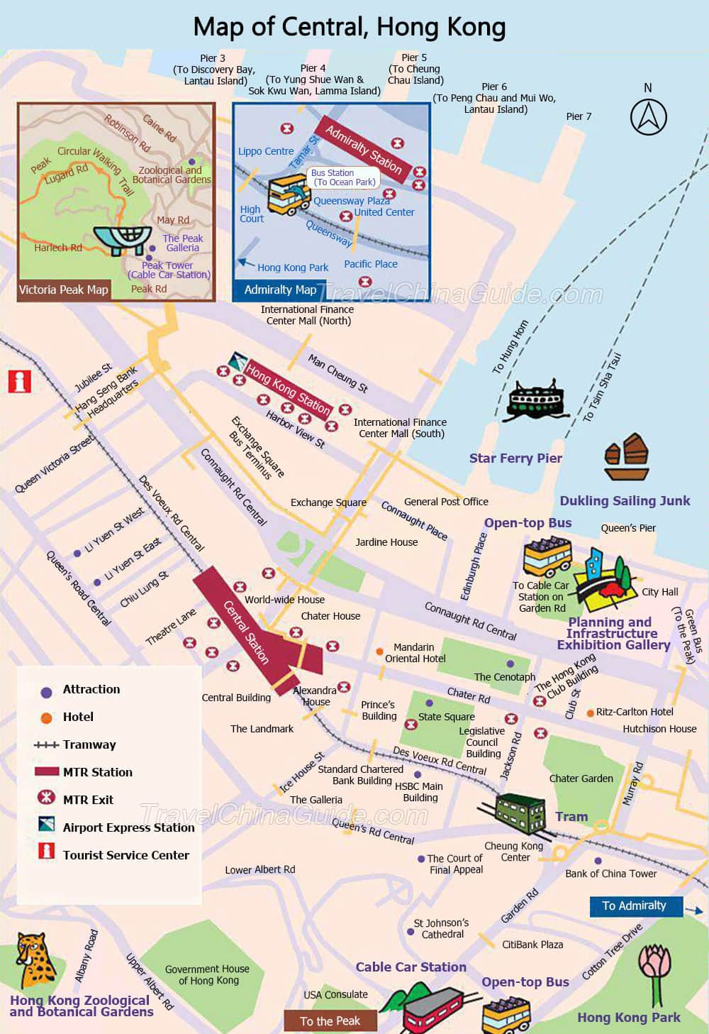
This is a tourist map of part of HK - Kowloon and HK Island. The transportation between the island and Kowloon relies on the Crossing Harbor Tunnel, the Airport Express Line, 3 MTR rails and ferry.
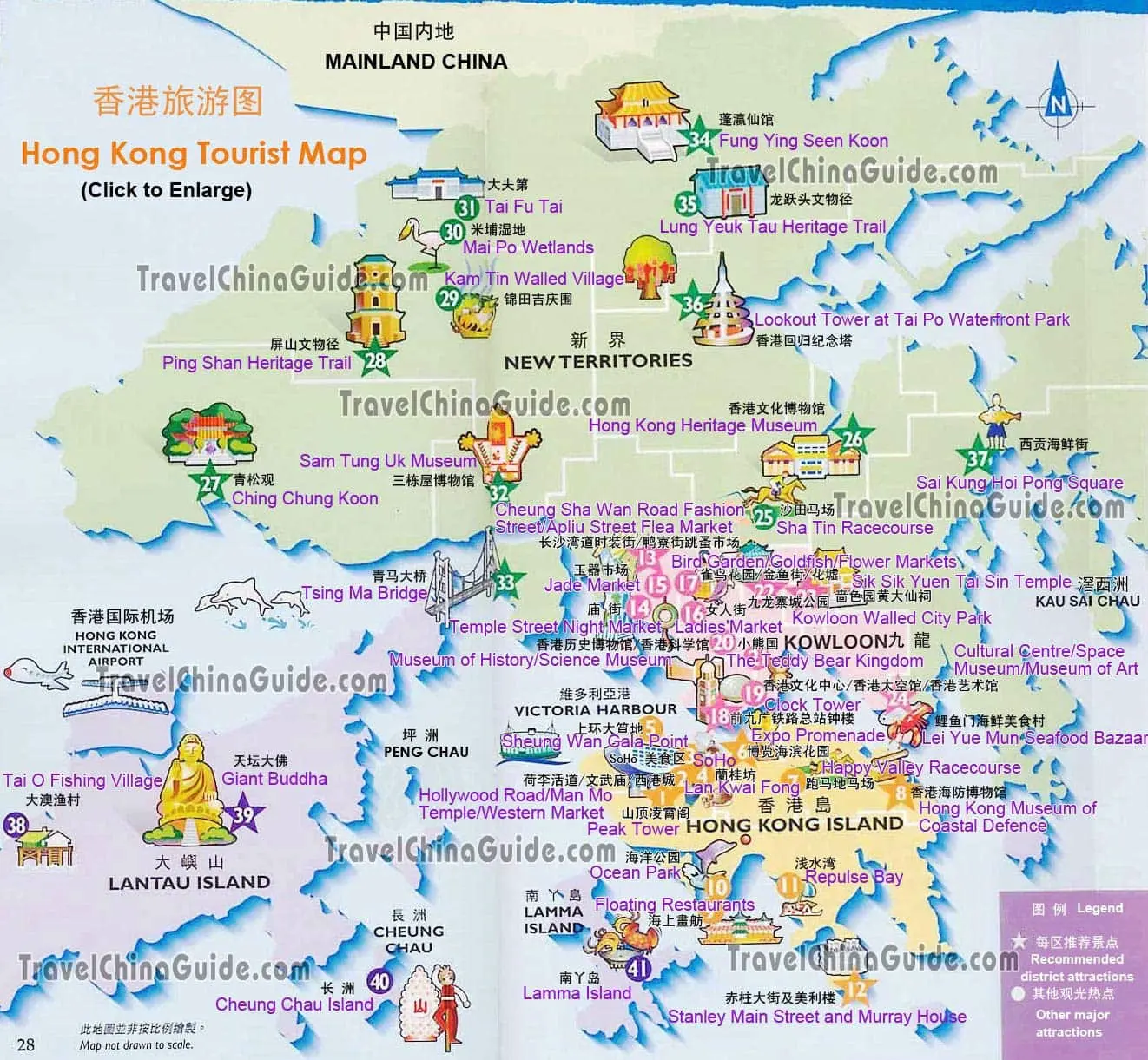
Hong Kong Tourist Map
Hong Kong Transportation Maps
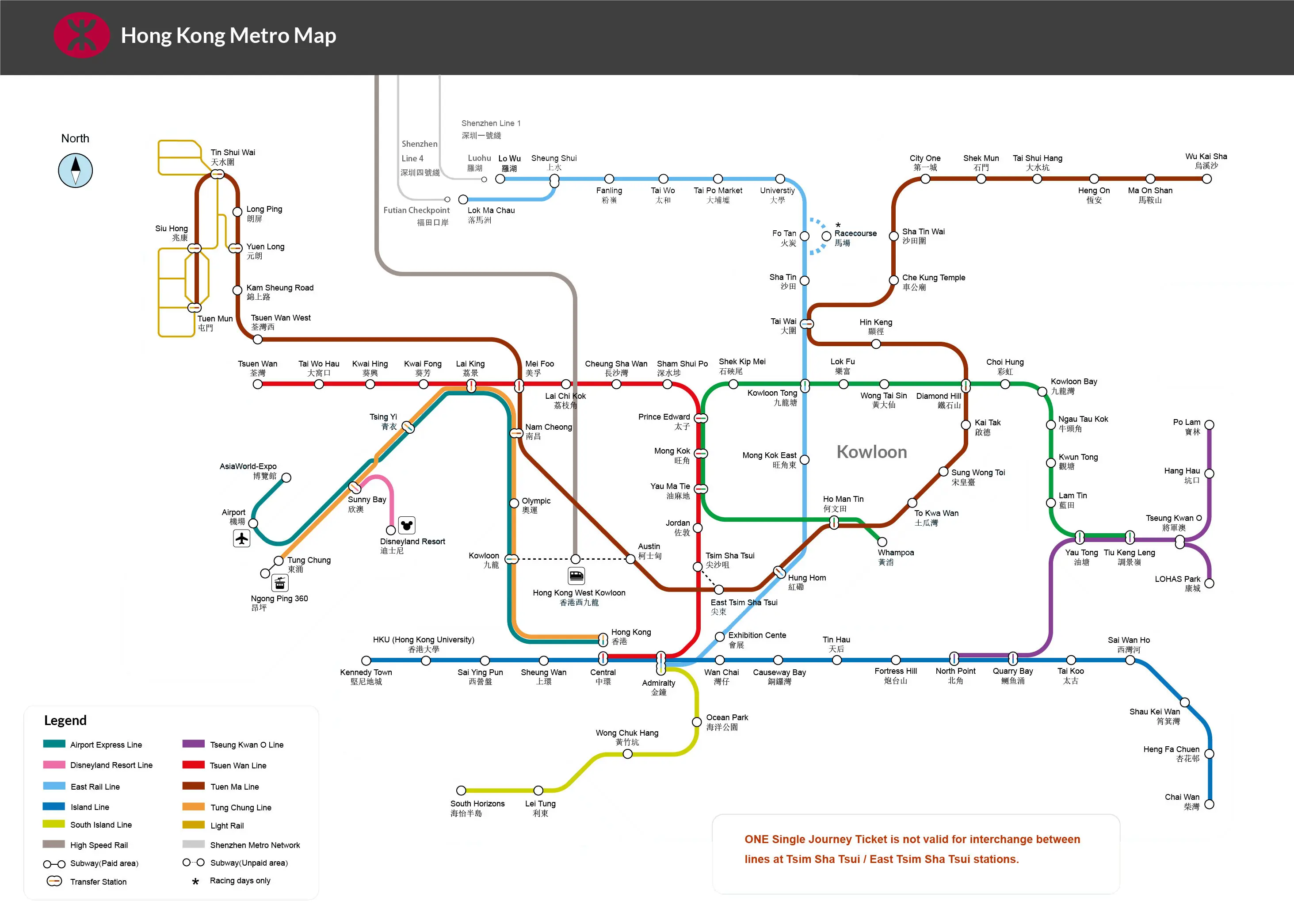
Metro Map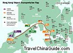
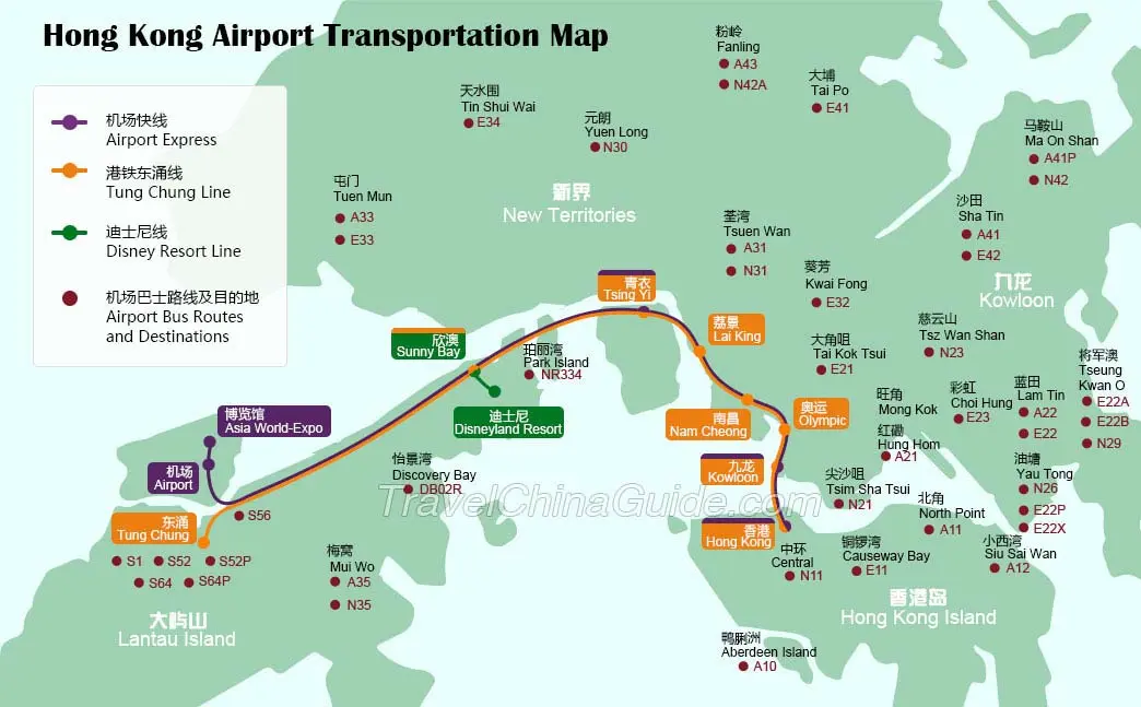
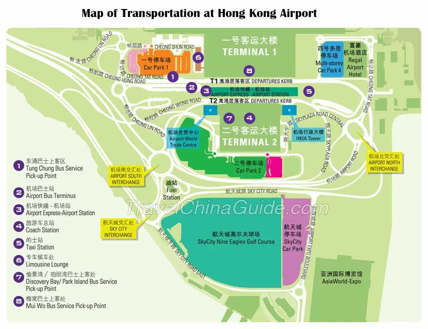
Airport
Transportation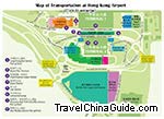
Airport Transfer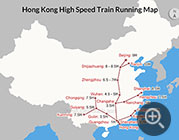
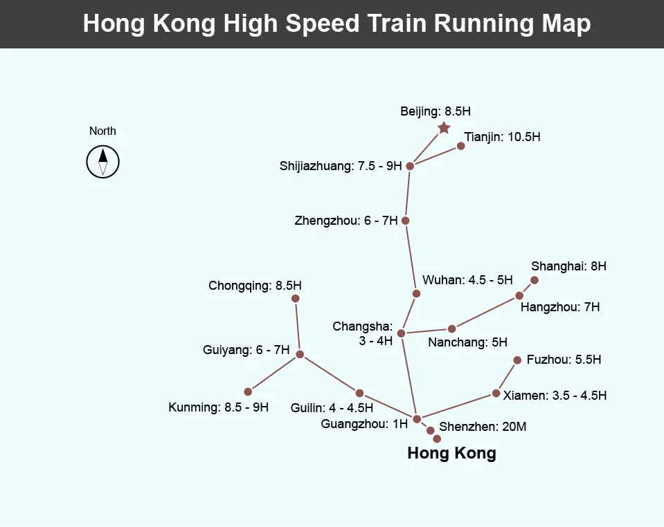
Train Map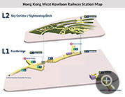
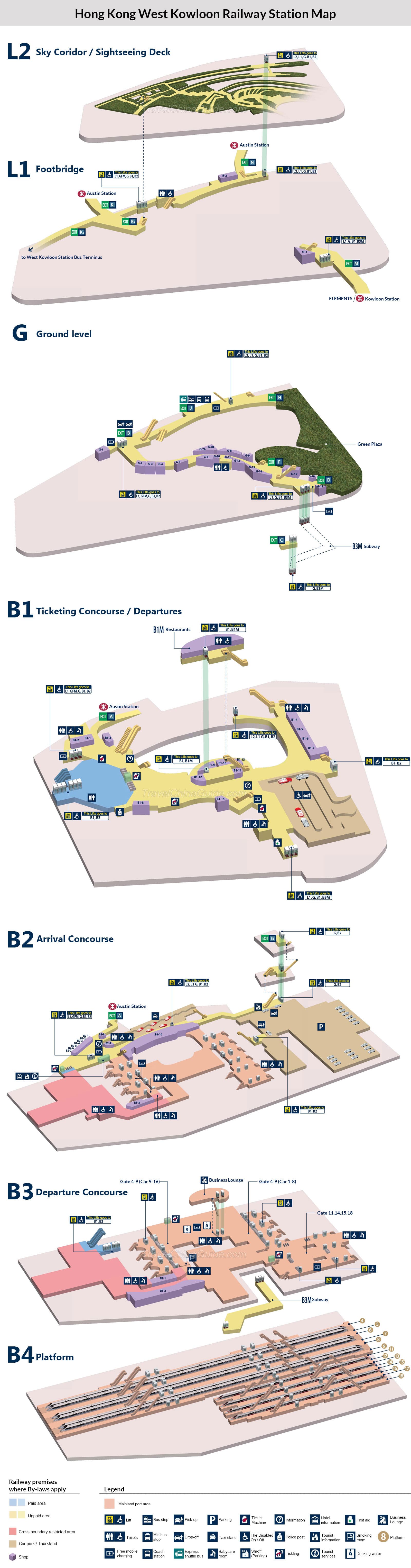
West Kowloon
Station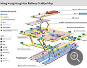
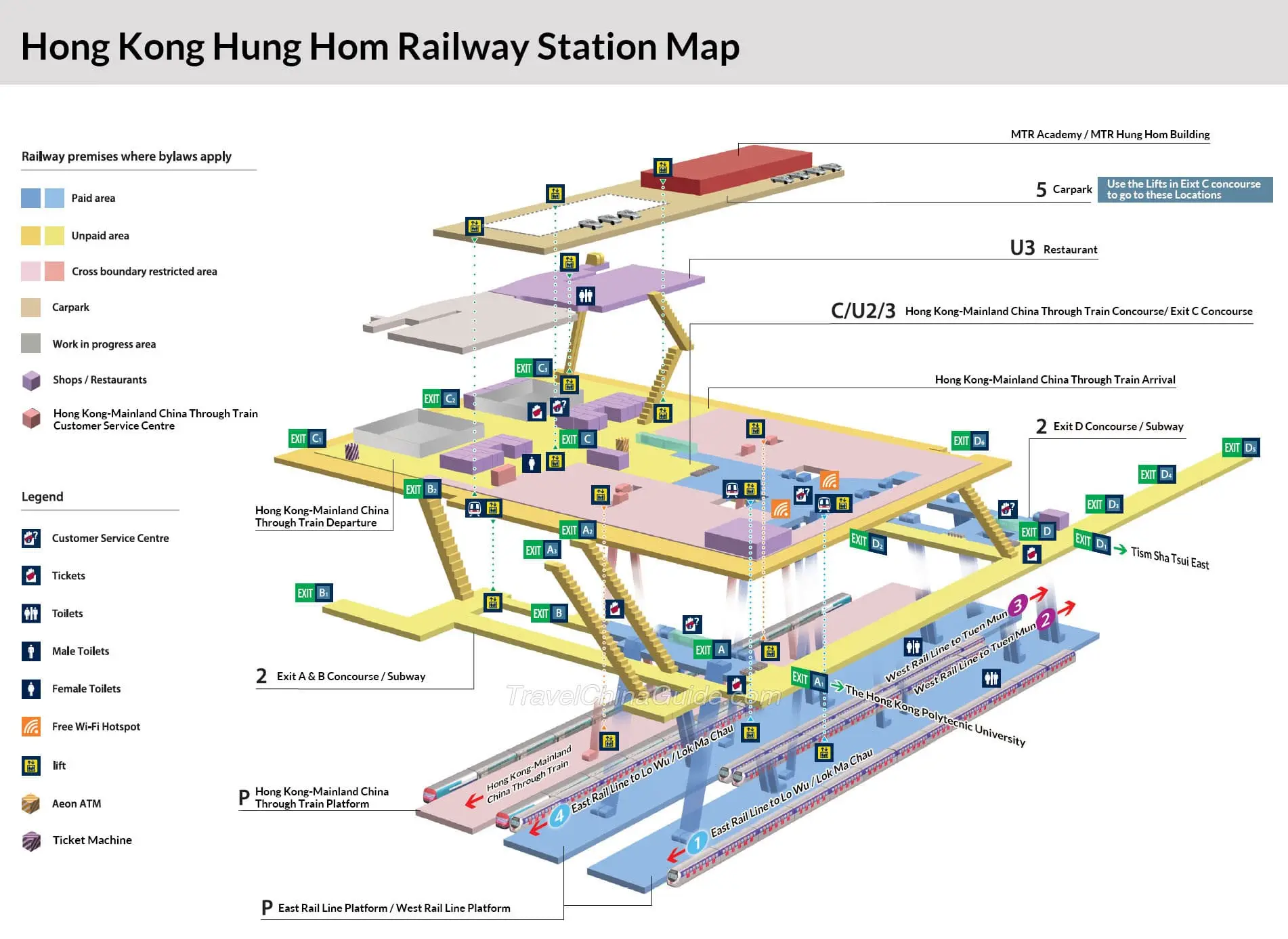
Hung Hom
Station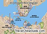
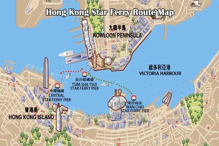
Star Ferry Map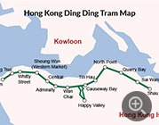
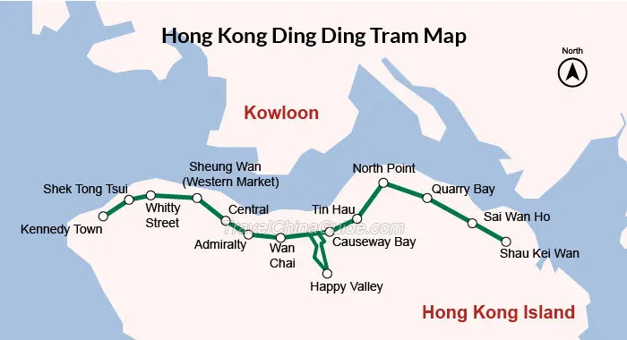
Ding Ding Tram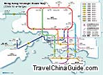
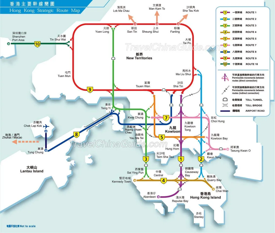
Major Roads Map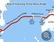
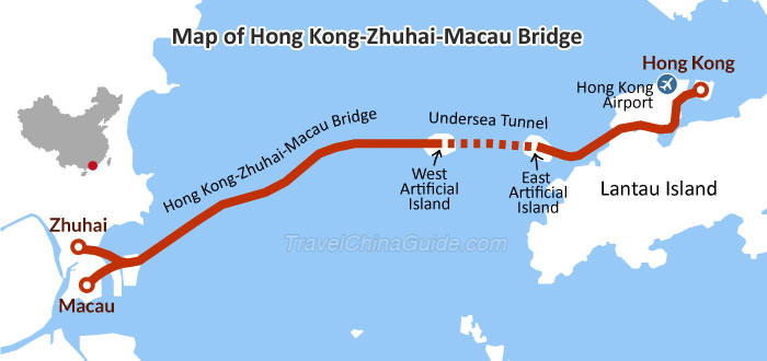
HK-Zhuhai-Macau
Bridge
Hong Kong Attraction Maps
- Last updated on Mar. 02, 2022 -
Questions & Answers on Hong Kong Maps
Asked by Sohel from BANGLADESH | Apr. 03, 2020 02:30 Reply
Reply
Is Hong Kong a part of China?
Answers (1)
Answered by Charlie from FINLAND | Apr. 06, 2020 20:56 0
0 0Reply
Yes, Hong Kong is definitely a part of China.
Asked by Sobur from NIGERIA | Apr. 02, 2020 11:30Reply
Where is Wuhan located
Answers (1)
Answered by Jennie from DENMARK | Apr. 02, 2020 20:2200Reply
Wuhan, the capital city of Hubei Province in central China, is situated on Jianghan Plain, a river-crossed fertile land created by the Hanjiang River joining the Yangtze River.
Asked by Cindy from MALAYSIA | Jan. 09, 2020 03:27Reply
How to go to zhuhai or Macau from tsim sha tsui?
Answers (1)
Answered by Sara from AUSTRALIA | Jan. 12, 2020 17:4300Reply
You can take taxi to China Ferry Terminal first and take ferry to Macau, which operates from 7:30 to 18:30.
Asked by angelita rubillos from PHILIPPINES | Nov. 28, 2019 22:59Reply
how far is The Harbourview hotel at 4 Harbour Road from Hong Kong Airport
Answers (1)
Answered by Theo from NEW ZEALAND | Dec. 02, 2019 01:3900Reply
Distance is around 40km.