Changji Travel Guide
Changji Facts
Chinese Name: 昌吉回族自治州 (chāng jí huí zú zì zhì zhōu)
Population: 1,600,000
Area: 73,900 square kilometers (28,533 square miles)
Location: in the central area of Xinjiang, northwest China
Administrative Division: 4 counties (Hutubi, Manas, Qitai, Jimsar); 1 autonomous county (Mori Kazak Autonomous County); 2 county-level cities (Changji, Fukang)
Area Code: 0994
Zip Code: 831100
GDP (2018): CNY 136.73 billion (USD 20.66 billion)
Nationalities: Han, Hui, Uygur, Kazak
A Charming City near to Xinjiang’s Capital, Urumqi
Situated in the center of Xinjiang, Changji Hui Autonomous Prefecture is bounded on the east by Urumqi and Hami in the neighborhood of Turpan in the south, while Mongolia lies to the northeast of the prefecture. The state capital Changji City is 38 kilometers (24 miles) away from Urumqi and 18 kilometers (11 miles) away from Urumqi International Airport. It is hard not to fall in love Changji with wonderful scenery in different places and seasons. The Heavenly Lake is certainly the central attraction in Changji. It is a half-moon-shaped lake on the northern side of Tianshan Bogda Peak.
Surprisingly, the manor scenery that often appears in European oil paintings can also be found in Changji. In the Jiangbulak Scenic Area, the golden wheat fields extend across the endless mountains in autumn. And near the fields are houses, cattle and sheep. Changji also presents the charming desert landscape in the east.
Attractions:
![]() Heavenly Lake, like a silver mirror, lies in the valleys below Bogda Peak, and was included into the Bogda Biosphere Reserve in 1990. The lake water is supplied by the melting ice and snow running off the surrounding peaks, and remains cold even in midsummer. Consequently, the lake is a well-known summer resort for the people of Xinjiang.
Heavenly Lake, like a silver mirror, lies in the valleys below Bogda Peak, and was included into the Bogda Biosphere Reserve in 1990. The lake water is supplied by the melting ice and snow running off the surrounding peaks, and remains cold even in midsummer. Consequently, the lake is a well-known summer resort for the people of Xinjiang.![]() Bogda Peak: It is the highest peak in the eastern part of the Tianshan Mountain range. Situated in the south of Fukang County it has an altitude of 5,445 meters (17,864 feet). The distances as the crow flies, from the peak to Urumqi and the Fukang county seat, are 60 and 49 kilometers (37 and 31 miles) respectively. It is one of the fifteen peaks of Xinjiang open to tourists.
Bogda Peak: It is the highest peak in the eastern part of the Tianshan Mountain range. Situated in the south of Fukang County it has an altitude of 5,445 meters (17,864 feet). The distances as the crow flies, from the peak to Urumqi and the Fukang county seat, are 60 and 49 kilometers (37 and 31 miles) respectively. It is one of the fifteen peaks of Xinjiang open to tourists.
There are two optional routes for the climb to Bogda Peak.
Route one: Tianchi Lake – Xiao Donggoukou – Da Dongkoukou – Sangecha Daban – Bogda Peak
Route two: Sigonghe – Lixing Daban – Bogda Peak
|
|
![]() Multicolored Bay (or Five Colored Bend): It is located in the north of Jimusar County, Changji Autonomous District, in the Gurbantunggut Desert. Covering an area of 3 sq kilometers (1.2 square miles), it has a typical wind erosion physiognomy and is believed to be the most beautiful one of its kind in Xinjiang Uygur Autonomous Region.
Multicolored Bay (or Five Colored Bend): It is located in the north of Jimusar County, Changji Autonomous District, in the Gurbantunggut Desert. Covering an area of 3 sq kilometers (1.2 square miles), it has a typical wind erosion physiognomy and is believed to be the most beautiful one of its kind in Xinjiang Uygur Autonomous Region.
Various colors in the bay account for its name. It is multicolored because of the burning of coal. Once a thick coal seam was formed under this area, and millions of years later, the coal seam was exposed and then burned by lightening and sunlight. Sintered rocks having different mineral substances piled up and this hilly area became multicolored with reddish brown as its main hue. Hills and rocks of Multicolored Bay have various shapes. Using imagination, you will find some look like pythons, while others resemble lions, ladies and pagodas. One of the hills is like a beauty wearing colorful clothes, while the hill snuggling up to it looks like a girl.
Visitors are advised to spend a night in Multicolored Bay. Responding to changes of sunlight, Multicolored Bay presents different scenery at different times. At noon, the bay is extremely hot as if the big fire extinguished for tens of thousands of years is rekindled. The colors of the hills generally become lighter in the direct rays of sunlight. The whole bay is like a nebulous picture, kindling everyone’s boundless imagination. At nightfall, Multicolored Bay becomes bright and colorful. The glowing sky blends well with the colored bay. The whole bay seems lit by the sun, and starts burning again. In the morning sun, the bay is enveloped in colored ribbons. To be in it is like a sweet dream.Multicolored Bay not only has an impressive landscape, but also abounds in oil, gold, agate, iron, zinc and other mineral deposits. Wild asses, pheasants and other animals live in the vegetated area.![]() Other Scenic Spots: Mori Euphrates Popular Forest
Other Scenic Spots: Mori Euphrates Popular Forest
|
|
How to Get to Changji
Changji is 38 kilometers (24 miles) from downtown Urumqi and 18 kilometers (11 miles) from Urumqi International Airport. Changji Railway Station is located 10 kilometers (6.2 miles) south of its city proper. In addition, the prefecture's central bus station is located in Wuyi Lu.
Weather
Basking in a continental climate, the prefecture has characteristically dry weather with great temperature variations between day and night. To the south, there are the obvious climatic features of the mountains, while to the north there is the typical climate of a dry desert. The average annual temperature is 6.8℃ (44.2℉). The transitional spring and autumn seasons between summer and winter, are short. Summer and autumn are the best seasons to visit the Prefecture. By avoiding the burning sun at noon, the summer here can be refreshing.
Changji Travel Tips:
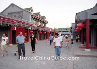
![]() History: China's central government of the day extended its sphere of influence to Changji with the establishment of the Protectorate of the West Region (Xiyu Duhufu) in 60BC during the Western Han Dynasty (206BC-24AD). In 1884, a province was set up to administrate Xinjiang, and this area belonged to Dihua Fu.
History: China's central government of the day extended its sphere of influence to Changji with the establishment of the Protectorate of the West Region (Xiyu Duhufu) in 60BC during the Western Han Dynasty (206BC-24AD). In 1884, a province was set up to administrate Xinjiang, and this area belonged to Dihua Fu.
![]() Physical Features: The prefecture lies at the foot of the Tianshan Mountains on the southeastern edge of the immense desert in the Junggar Basin. The terrain in which Changji is situated inclines to the south and is part of the hinterland of Asia.
Physical Features: The prefecture lies at the foot of the Tianshan Mountains on the southeastern edge of the immense desert in the Junggar Basin. The terrain in which Changji is situated inclines to the south and is part of the hinterland of Asia.
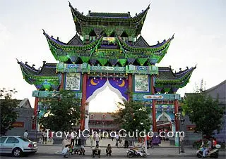
![]() Local Highlights: Hua'er refers to the most popular folk songs of the Hui people. These are native to the area around Ningxia, Gansu and Qinghai province and later included Changji. The irregularly held folk song festivals attract the participation of many local singers. Corban Festival and Ramadan Festival are the festivals for the Uygur, Kazak, Hui and many other ethnic minorities who are followers of Islam.
Local Highlights: Hua'er refers to the most popular folk songs of the Hui people. These are native to the area around Ningxia, Gansu and Qinghai province and later included Changji. The irregularly held folk song festivals attract the participation of many local singers. Corban Festival and Ramadan Festival are the festivals for the Uygur, Kazak, Hui and many other ethnic minorities who are followers of Islam.
![]() Special Local Products: Melons, hops, grapes, Fernle mushrooms, roast lamb, roast whole sheep, hand-made yellow noodle
Special Local Products: Melons, hops, grapes, Fernle mushrooms, roast lamb, roast whole sheep, hand-made yellow noodle