Map of China Provinces & Cities
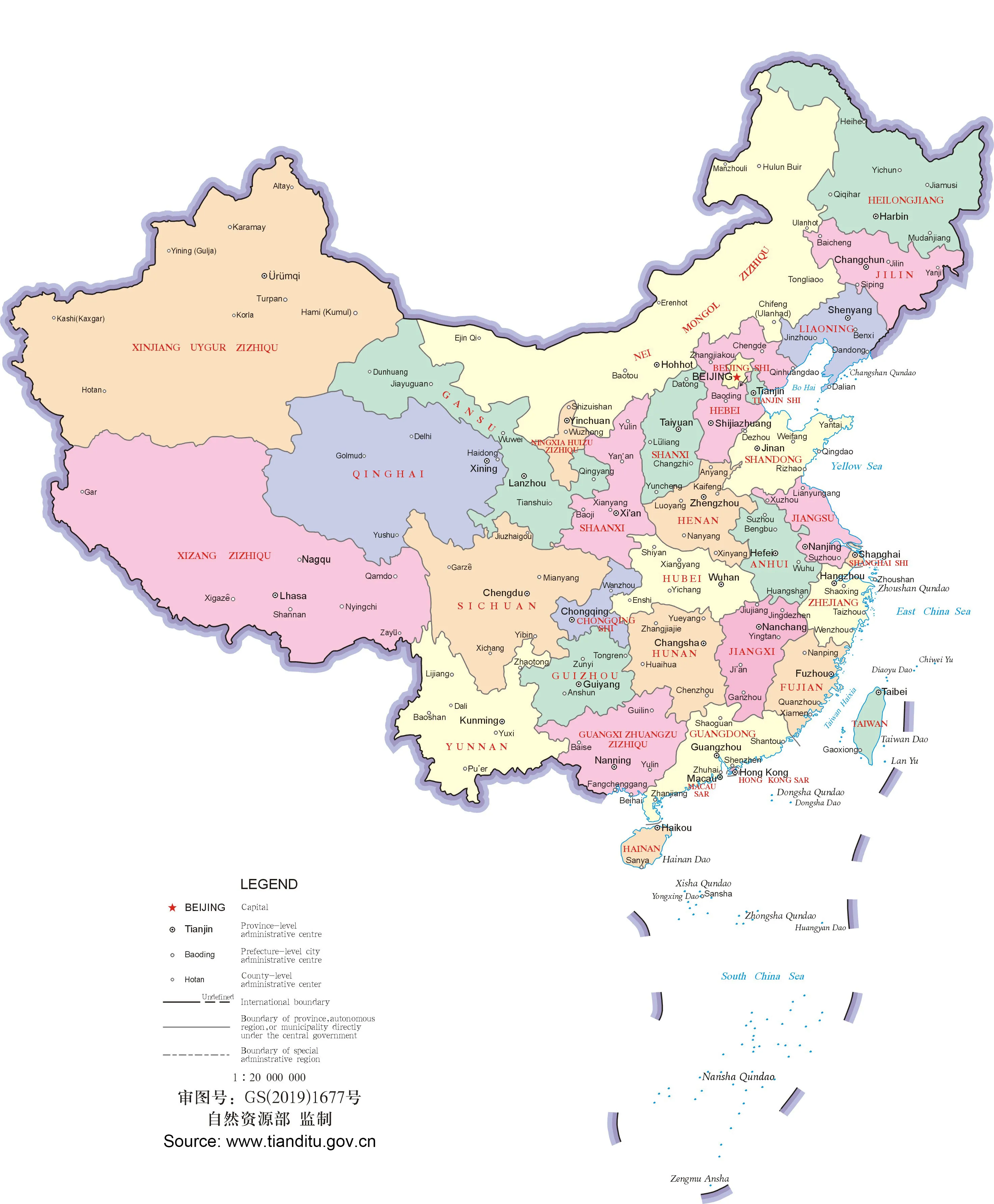
The following map shows an overall view of China's land area of about 3.7 million sq mi (9.6 million sq km) on a scale of 1:9,000,000. The territorial waters and neighboring countries are also included. The country’s provinces, major cities, together with popular tourist attractions are marked to facilitate visitors to China.
 |
Province Map
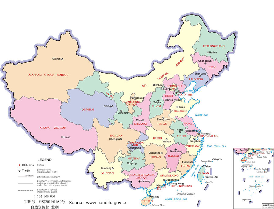
China has 34 provincial-level administrative units: 23 provinces, 4 municipalities (Beijing, Tianjin, Shanghai, Chongqing), 5 autonomous regions (Guangxi, Inner Mongolia, Tibet, Ningxia, Xinjiang) and 2 special administrative regions (Hong Kong, Macau).

More Maps of Provinces:
- Anhui
- Fujian
- Gansu
- Guangdong
- Guangxi
- Guizhou
- Hainan
- Hebei
- Heilongjiang
- Henan
- Hubei
- Hunan
- Inner Mongolia
- Jiangsu
- Jiangxi
- Jilin
- Liaoning
- Ningxia
- Qinghai
- Shaanxi
- Shandong
- Shanxi
- Sichuan
- Taiwan
- Tibet
- Xinjiang
- Yunnan
- Zhejiang
- Last updated on Jul. 23, 2026 by Sule Su -