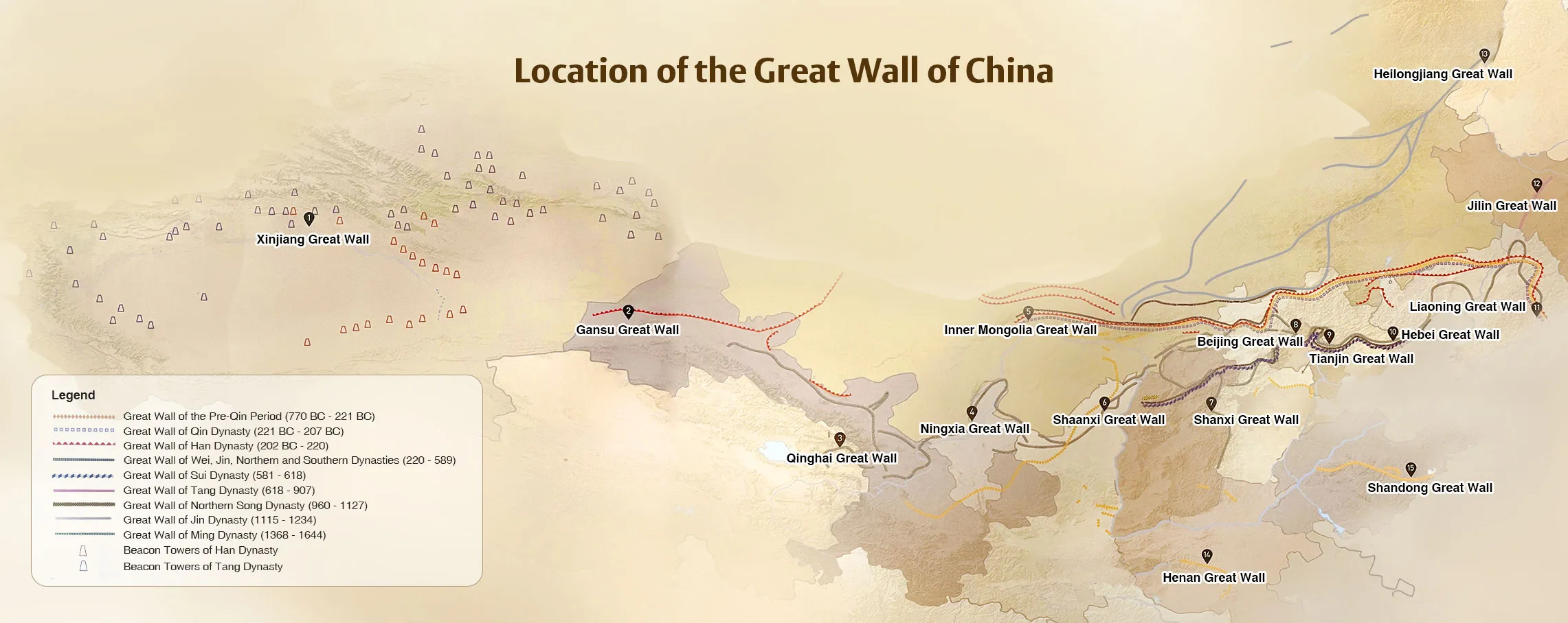
Great Wall Location on China Map
Beijing is a city rich in Great Wall resource. The history of the wall in Beijing can be traced back to Warring States Period (476 BC-221 BC). The
Ming Dynasty (1368-1644) is the heyday of the Wall construction. At present, most sections remained in Beijing were built in Ming Dynasty.
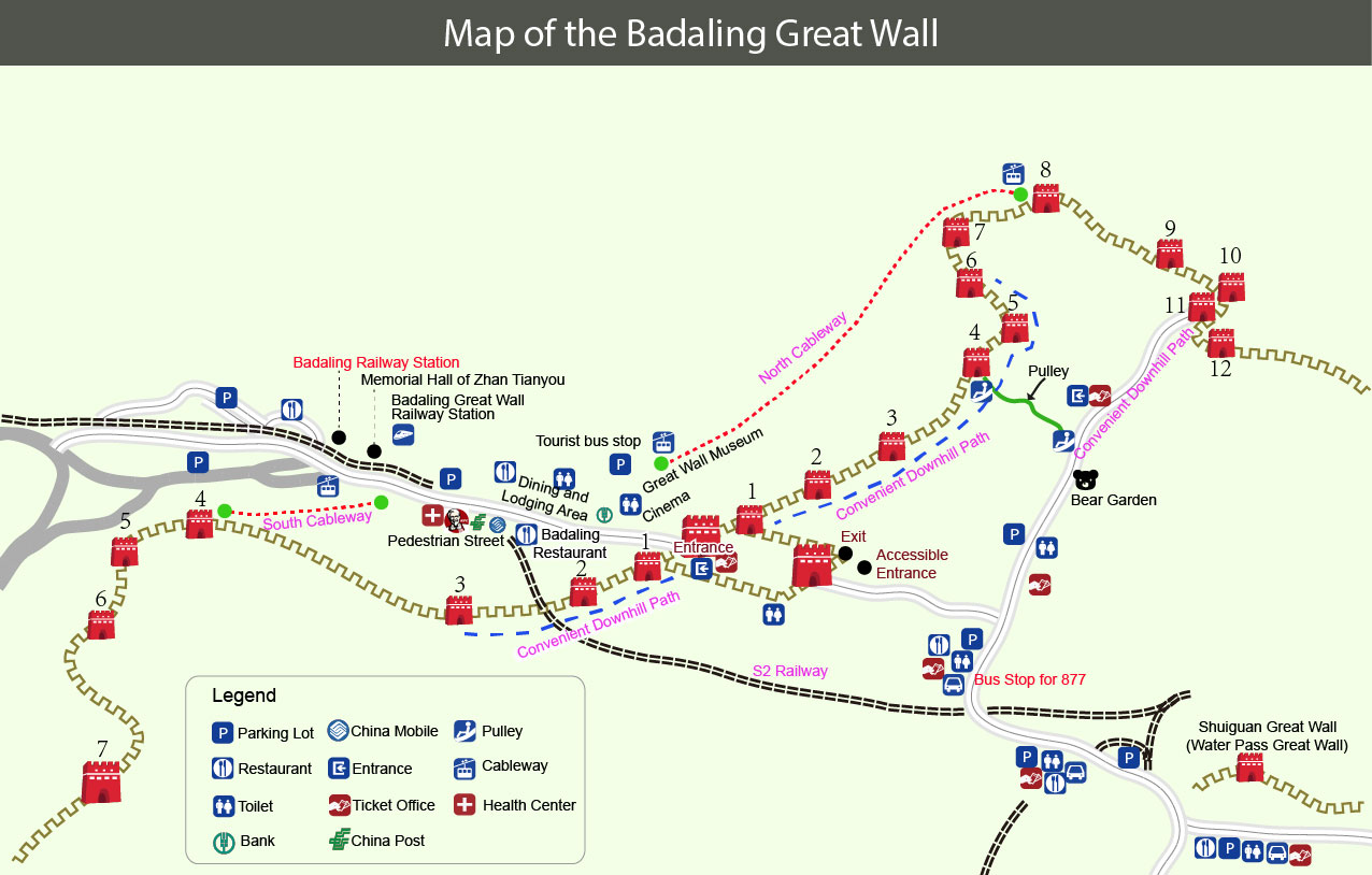
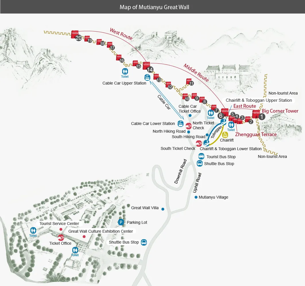
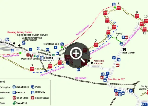 | | Badaling Great Wall Map | | 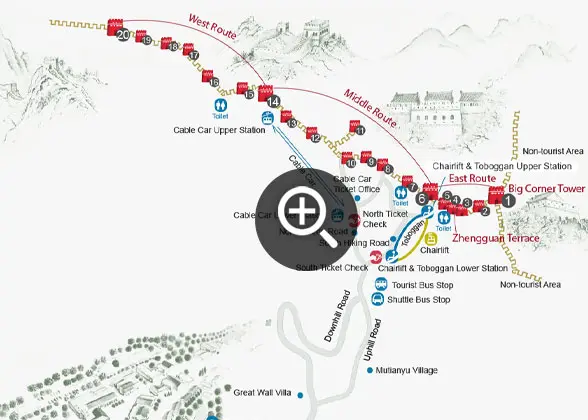 | | Mutianyu Great Wall Map | |
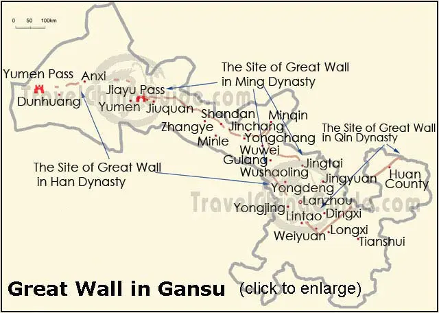
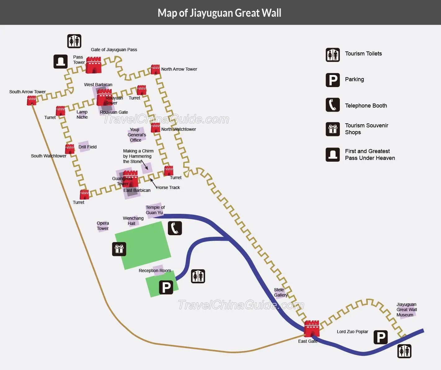
According to a survey, the Wall in Ming Dynasty (1368-1644) extended about 1738.3km (1,080 miles) in Gansu, which covers one fifth of the total length of that in China. But except a few repaired sections, many parts are just left suffering the natural erosion and human demolishment. It is urgent to protect and rescue it.
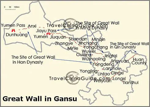 | | Gansu Great Wall Map | | 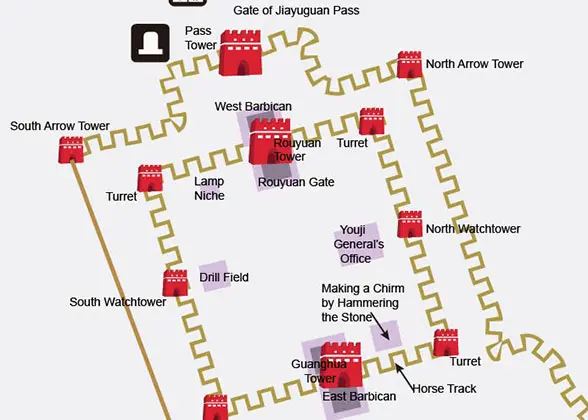 | | Map of Jiayuguan Great Wall | |
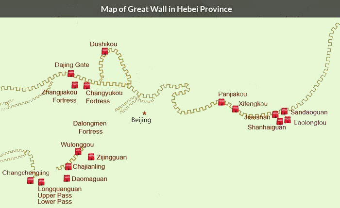
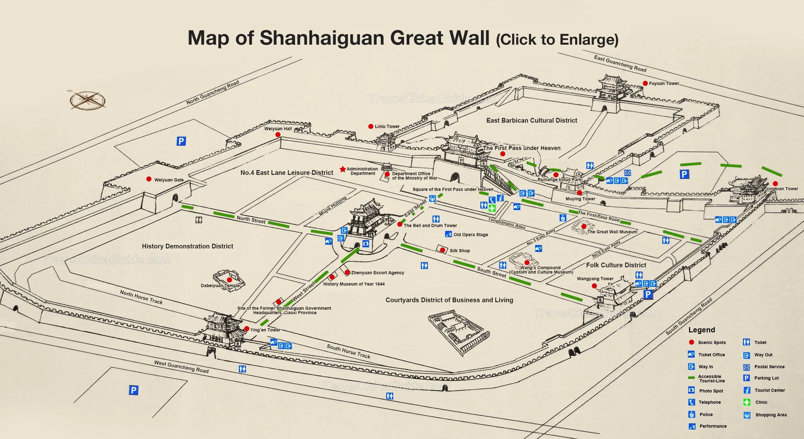
The Wall in Hebei belongs to different dynasties, and the sections in Ming Dynasty are the most famous. The 2,000km (1,243 miles) walls in Hebei wind through Qinhuangdao, Chengde, Zhangjiakou, Tangshan and Baoding in the province. Due to their approach to Beijing, the capital of Ming Dynasty, the walls were strongly built, reflecting the top level of building standard in that period. Among these walls, many sections are world-known scenic sights, such as "Old Dragon Head", "The First Pass under Heaven", Zhangjiakou and Jiaoshan.
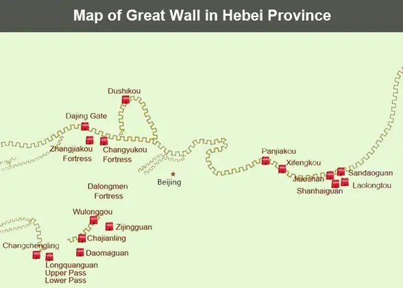 | | Map of the Great Wall in Hebei | |  | | Map of Shanhaiguan Great Wall | |
Liaoning Great Wall Maps
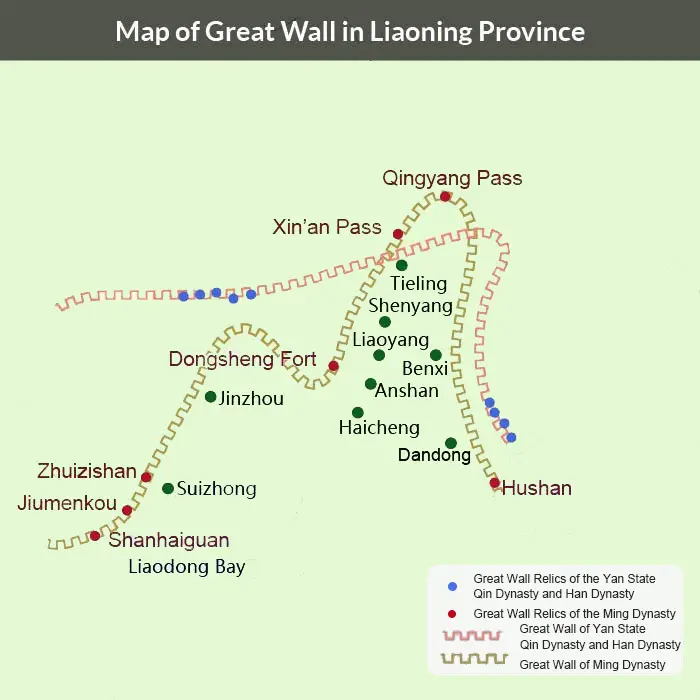
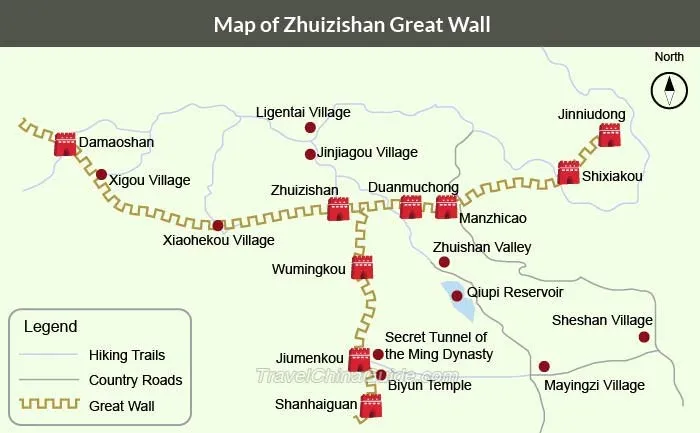
The Wall in Liaoning has a total length of 1,460 miles (2,350 kilometers). It was built during many historical periods between the Warring States Period (475BC-221BC) and the Ming Dynasty (1368-1644). The remaining sections are mostly from the Ming Dynasty, including Hushan, Jiumenkou, and Zhuizishan.
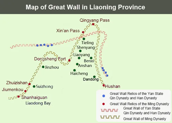 | | Map of the Great Wall in Liaoning | | 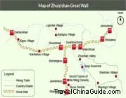 | | Map of Zhuizishan Great Wall | |
Shaanxi Great Wall Maps
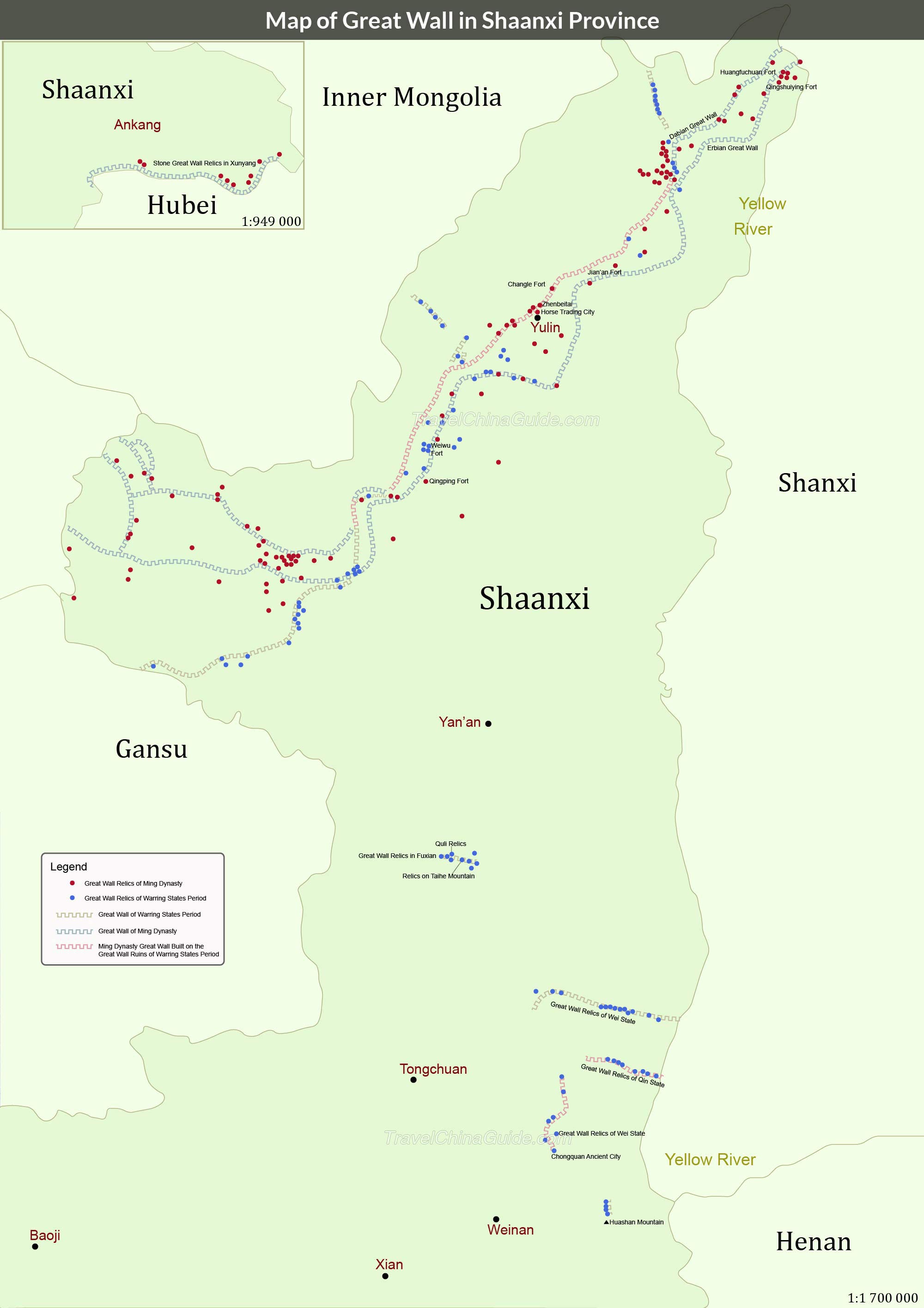
In Shaanxi, the Wall was constructed in many dynasties from the Warring States Period (475BC-221BC) to the Ming Dynasty (1368-1644). The total length adds up to over 1,243 miles (2,000 kilometers). Today, the relics are mainly found in Yulin, Yan’an and Weinan. Due to natural erosions and human activities, the wall was badly damages. It is time to protect and restore it.
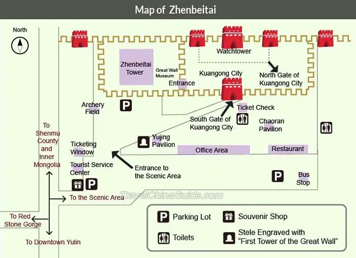
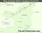 | | Map of the Great Wall in Shaanxi | |  | | Map of Zhenbeitai Great Wall | |
The Great Wall measures over 3,500km (2,475 miles) in Shanxi Province, which are found widely in over 40 counties and in nine cities. In history, the Warring States, Northern Qi, Northern Zhou, Sui, Song, Ming and Qing dynasties all built walls in Shanxi. The sections in Ming Dynasty are the largest in scale. It cost about 154 years to finish the construction. The wall in Shanxi was always serving as the barrier to protect Beijing.
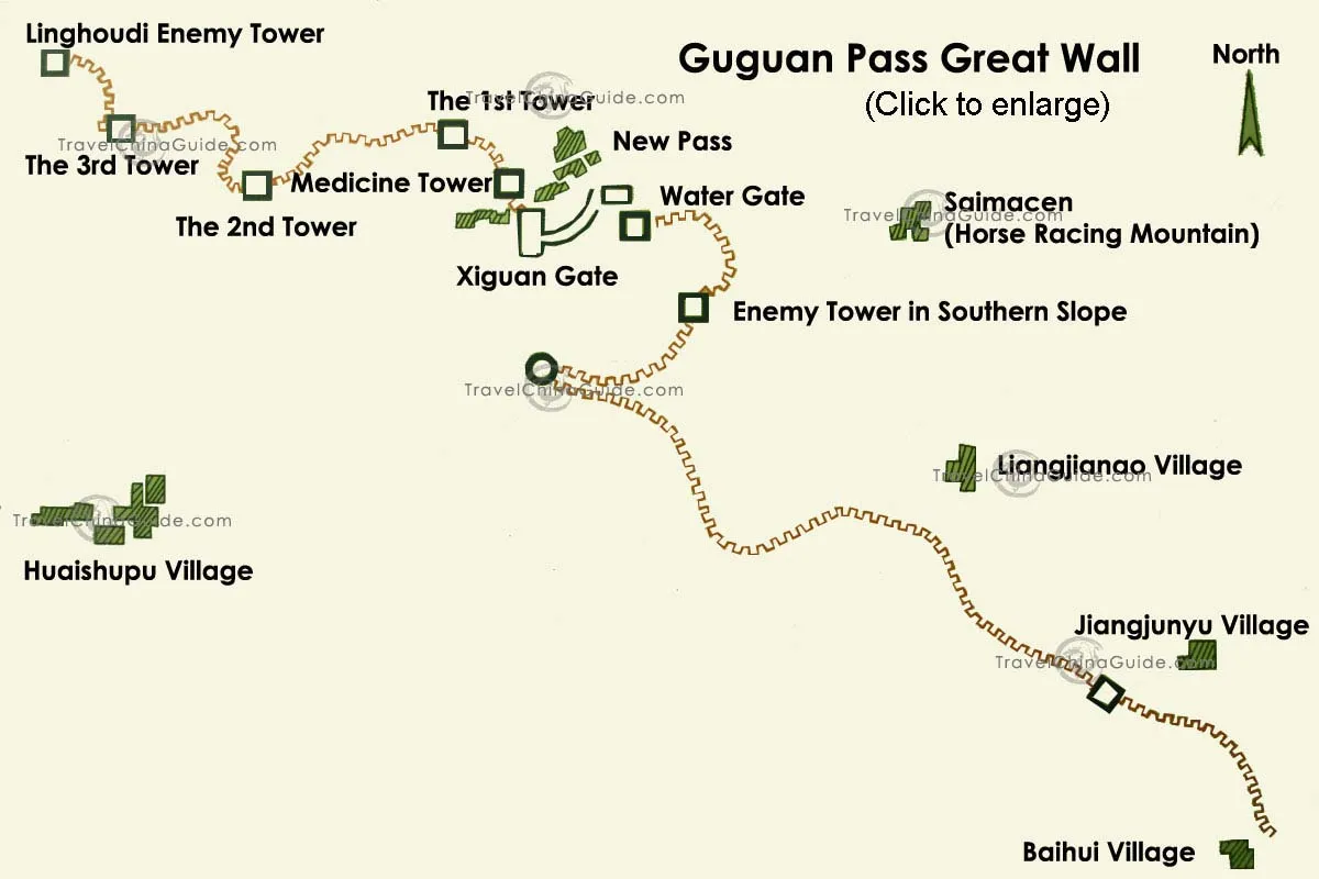
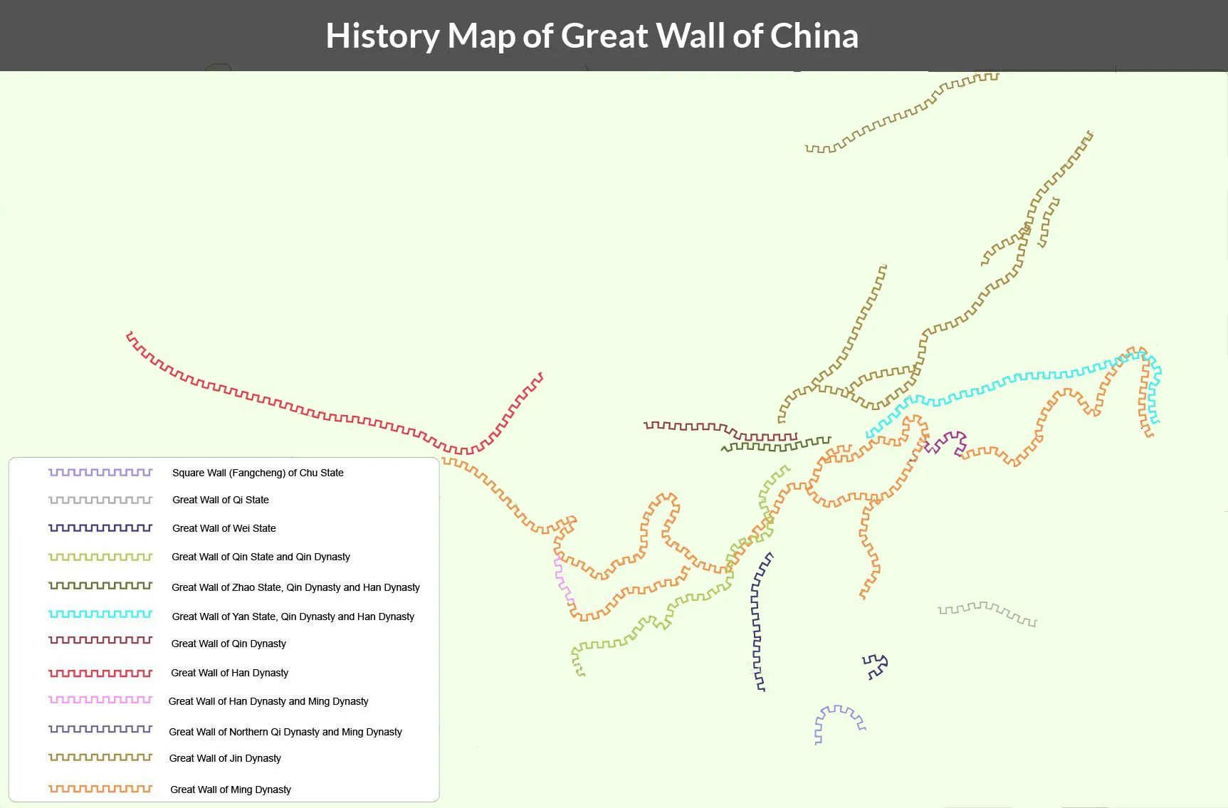
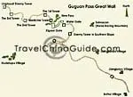 | | Map of Guguan Pass | | 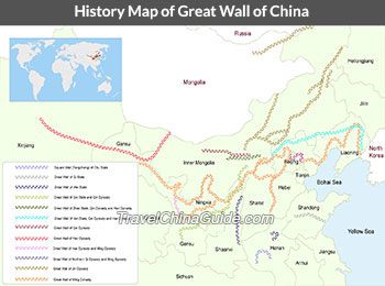 | | Great Wall History Map | |
In Chinese long history, many feudal dynasties have built or repaired the Great Wall in order to consolidate their frontier defense. Millions of ancient Chinese laborers have contributed their wisdom, blood and sweat to make it a wonder in the world. Every constructional detail reflects the defensive ideas and the high achievement of building technology in ancient China.
Today, through thousands of years’ erosion, most parts of the Wall are beyond recognition. By reading these China wall maps, you will get to know the historical remarks left by each dynasty and be marvel at the long history and abundant resources of this huge project in China.
- Last updated on Feb. 04, 2026 by Sherry Xia -