Zhengzhou Map
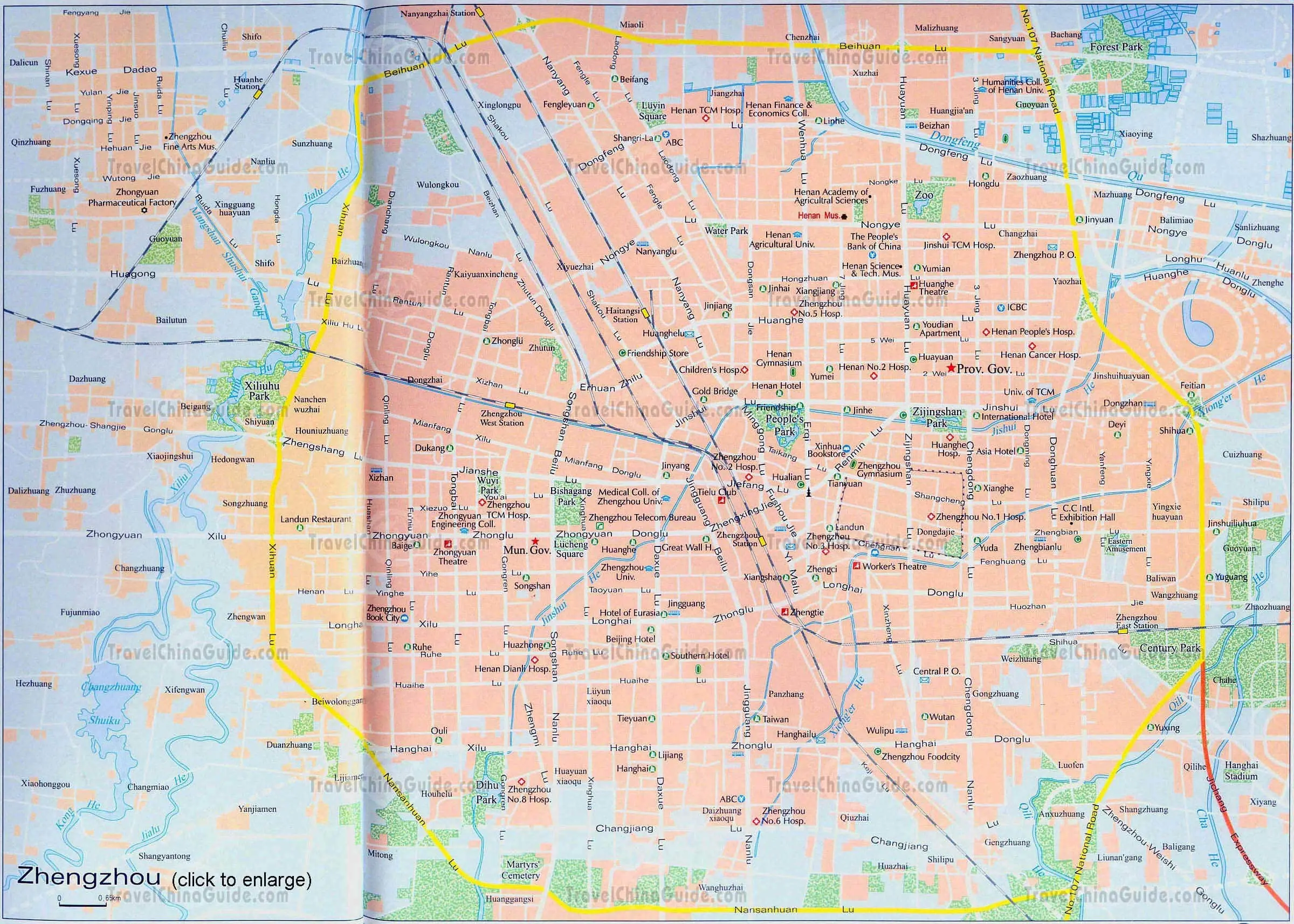
Zhengzhou is the capital city of Henan Province. It is located in north central Henan Province, adjoins the Yellow River on the north and leans against the Songshan Mountain on the west. The Dongfeng Qu (Dongfeng Ditch), which is used for diverting water from the Yellow River to irrigate, is the highlight of the local attractions.
The city is one of the five most important transportation hubs in China. The Jingguang Railway and the Longhai Railway join there together. From the city map above, you can see West Railway Station, East Railway Station, Zhengzhou Railway Station, Huanhe Railway Station and Haitansi Railway Station. At present, only the Zhengzhou Railway Station provides passenger transport service.
The No.107 National Highway crosses the city and the Jichang Expressway leads to the Xinzheng Airport. The downtown Zhengzhou lays out regularly. The major roads include Jingguang Nanlu, Jingguang Beilu, Longhai Donglu, Longhai Zhonglu, Huayuan Lu, Zijingshan Lu, Hanghai Zhonglu, Hanghai Xilu and Hanghai Donglu, etc.