Guangzhou Maps

Click the map to enlarge it.

Guangzhou City Map

Guangzhou Map with main streets, scenic spots


Guangzhou is located in the central south of Guangdong, on the north edge of Pearl River Delta. As China's south gateway, it adjoins Hong Kong and Macau. In the city map, you can see Zhujiang (Pearl River) flows through the city and it divides the city into several districts. The major tourist attractions are shown in red in this map, such as Temple of Six Banyan Tree, Huangdaxian Temple and Guangdong Museum.

Guangzhou Location Map

Guangzhou location map
 

Guangzhou Tourist Map
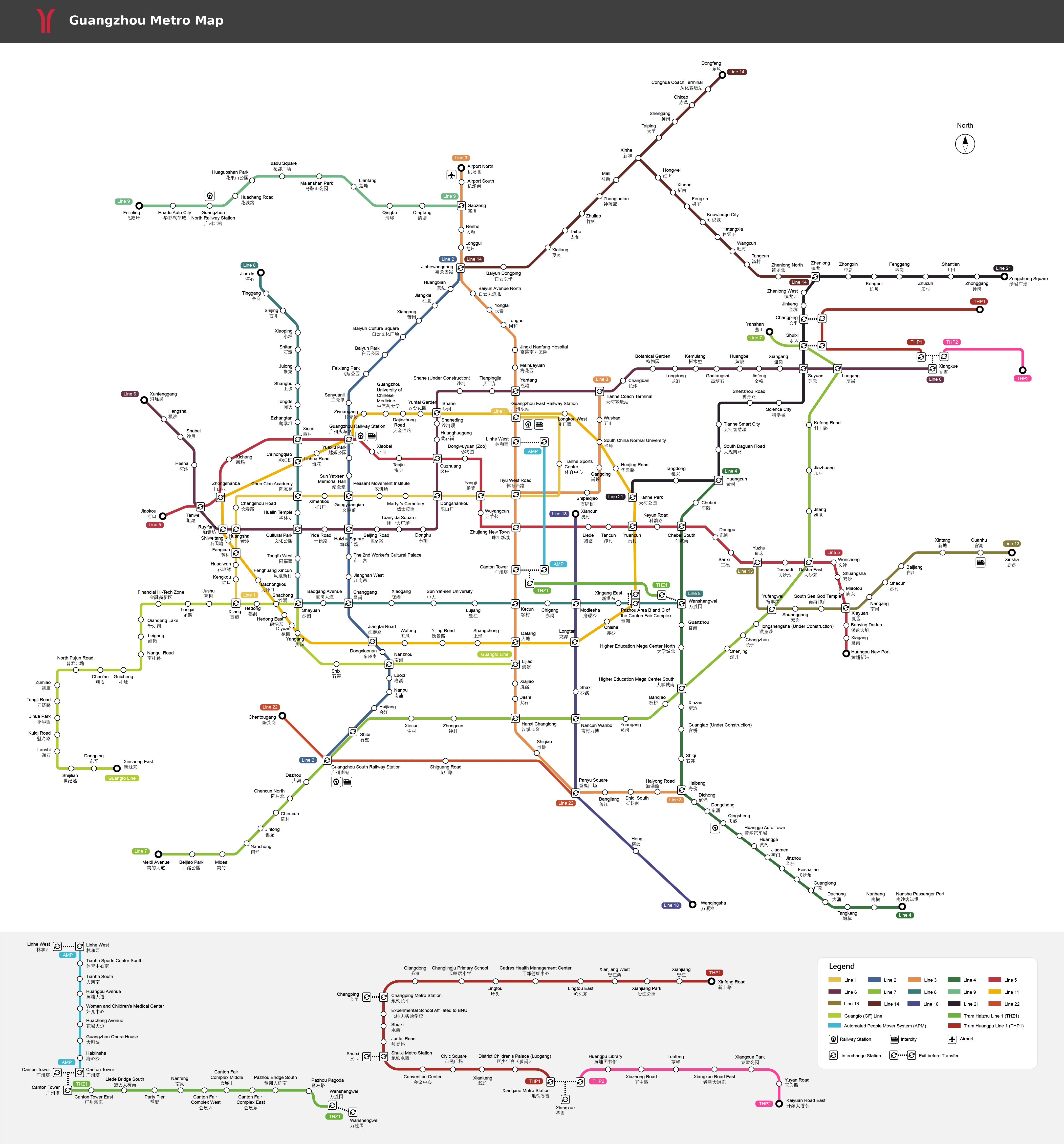
Guangzhou tourist map

Guangzhou Metro Map

Guangzhou subway map with major metro lines in operation

  More Guangzhou Metro Maps

  More Guangdong Maps

- Last updated on Dec. 29, 2020 -
Questions & Answers on Guangzhou Maps
Asked by Merly Nonoy from PHILIPPINES | Nov. 01, 2019 23:28Reply
Where is the hop on hop off bus located in Guangzhou?
Answers (1)
Answered by Momo from MALAYSIA | Nov. 04, 2019 19:59
00Reply


There are three sightseeing bus lines that you can take at different stops. For example, you can get on at Guangzhou Tower stop, Baiyunshan scenic area, Beijing Road, etc.
Ask a Question
Question Summary (100 characters)
Details (optional) (2,000 characters)
NameCountryEmail