Route of Silk Road
The Silk Road was originally opened up by Zhang Qian and it gradually formed in the Han Dynasty (206 BC-220 AD).
In the Han Dynasty, the ancient road originated from the historical capital of Chang'an (now Xian). This China trade route ran through Gansu Province via Tianshui, Lanzhou, Wuwei, Zhangye, Jiuquan, Jiayuguan (an important military garrison and barrier of the Great Wall) and Dunhuang along the Hexi Corridor. Dunhuang is famous for its Mogao Caves and other cultural relics. It was also a key point of the route, where the trade road divided into three main branches: the southern, the central and the northern.
The three main routes spread all over the Xinjiang Uygur Autonomous Region.
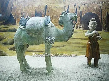 |
| Statue of Travelling along the Ancient Road |
The Central Route ran west along the southern foot of Tianshan Mountains, passing Loulan (now Ruoqiang), Turpan , Korla, Kuche (Kuqa), Aksu and Kashgar, afterwards went over the freezing Pamirs, wound to Mashhad via the Fergana Basin, Samarkand, Bukhara and finally joined the Southern Route.
The Northern Route went west along the northern foot of Tianshan Mountains, taking merchants westwards to Hami (Kumul), Urumqi and Yining, and then reached the areas near the Black Sea, the Caspian Sea and the Mediterranean Sea.
According to some experts, the total length of the historically important trade route is about 10,000 kilometers (6,214 miles), among which approximately 3,000 kilometers (1,864 miles) of the route are inside China's territory. Nowadays, the immemorial Silk Road spreads over the five provinces in the Northwest Territories including Shaanxi Province, Gansu Province, Qinghai Province, Ningxia Hui Autonomous Region and Xinjiang Uygur Autonomous Region. The road made a great contribution to the political, economic and cultural exchange between China and Central Asia, West Asia, India, Roman and Europe.![]() Further Reading:
Further Reading:![]() Maritime Silk Route
Maritime Silk Route ![]() Southern Silk Road
Southern Silk Road
![]() Nowadays, the ancient road is still catching the attention of the world with its large number of historical and cultural sites, splendid natural scenery and colorful ethnic customs. Benefiting from the increasingly convenient transportation network, travelers can travel along this route more easily than before. Pack up and get a taste of the ancient oriental culture by taking one of the China routes below.
Nowadays, the ancient road is still catching the attention of the world with its large number of historical and cultural sites, splendid natural scenery and colorful ethnic customs. Benefiting from the increasingly convenient transportation network, travelers can travel along this route more easily than before. Pack up and get a taste of the ancient oriental culture by taking one of the China routes below.
![]() China Delights: 10-Day Beijing - Xian - Guilin - Shanghai
China Delights: 10-Day Beijing - Xian - Guilin - Shanghai![]() Classical Silk Road: 14-Day Beijing - Urumqi - Kashgar - Urumqi - Dunhuang - Xian - Shanghai
Classical Silk Road: 14-Day Beijing - Urumqi - Kashgar - Urumqi - Dunhuang - Xian - Shanghai![]() Silk Road In-depth: 22-Day Beijing - Urumqi - Korla - Kuqa - Aksu - Kashgar - Hetian - Minfeng - Korla - Turpan - Dunhuang - Xian - Shanghai
Silk Road In-depth: 22-Day Beijing - Urumqi - Korla - Kuqa - Aksu - Kashgar - Hetian - Minfeng - Korla - Turpan - Dunhuang - Xian - Shanghai