Shangri-La Weather in February
Season: Winter
In February, the temperature is low in Shangri-La with big gap: in a day, the maximum temperature is around 10°C (50°F), while the minimum can be as low as around -5°C (23°F). You should note that the temperature drops drastically at night, so you’d better wear more if you plan to go out after sunset. Besides, when it snows, it may be colder than normal as well, but the good news is that there are not many snowy days this month. The humidity is low because of the low rainfall and high latitude, and you may need to take some moisturizing measures.
 |
| Ancient Town of Shangri-La |
In 2027, the early February coincides with the Chinese New Year holiday, when the traffic will be heavier and airfare and hotels will be more expensive. If you plan to visit Shangri-La during this period, it is recommended to make reservations as early as possible. Except for these days, Shangri-La in February is quiet and not busy.
See more about Yunnan Weather in February.
Averages for Shangri-La Weather in February
High Temperature: 7°C (45°F)
Low Temperature: -6°C (21°F)
Precipitation: 20 mm in 8 days
Humidity: 61%
Sunrise: 07:46 ~ 08:08
Sunset: 19:00 ~ 19:20
Daylight Hours: 10.51 ~ 11.34 h
Sunshine Hours: 7 h
Packing List for Shangri-La Trip in February
 |
(1) Due to the high altitude, sunglasses, sunscreen, and other sun protection items are necessary to protect you from strong UV rays.
(2) To keep hydrated in the dry February, you’d better pack face moisturizers, lip balms, and water bottles.
(3) You are recommended to bring warm hats and scarves, especially if you plan to start your day’s visit in the early morning.
Top Things to Do in Shangri-La in February
Travel Recommendation Rate: 
February 7th, 2027 marks a traditional festival of local Tibetan people in Shangri-la: the Tibetan New Year, which is a great opportunity for visitors to experience Tibetan culture. Visiting Shangri-La during this period, you will see characteristic Tibetan decorations for the festival. In addition, because the Tibetan people believe in Buddhism, on the day of the festival, you will see them dressing up and going to Buddhist temples to pray for blessings. There will also be celebrations in Dokuzong Ancient Town, including performances of traditional Tibetan dances and songs.
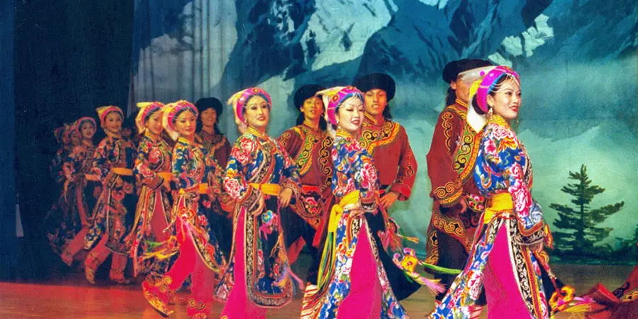 |
| Performance of Tibetan New Year |
February, when the rainfall is low and the visitors are fewer, is a good time to go hiking in Tiger Leaping Gorge. This month, you will see a tranquil and beautiful view there, which is completely different from that of the wet season. The water of the Jinsha River is turquoise, and Jade Dragon Snow Mountain and Haba Snow Mountain are still capped by snow. If you spend two days there, you will have the chance to admire a beautiful starry sky at night and the dramatic view of the golden sunrise shining on the snowy mountains in the early morning.
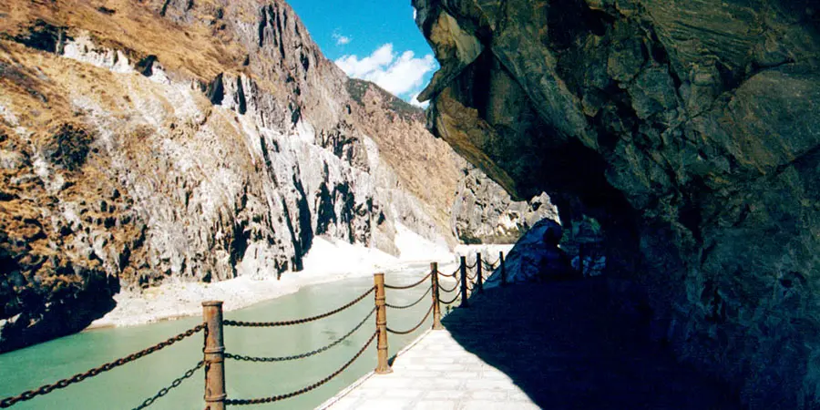 |
| Turquoise Jinsha River of Tiger Leaping Gorge |
When you come to Shangri-La, Songtsamling Monastery, known as the “Little Potala Palace”, is one of the must-see attractions. Its highlights include: its traditional Tibetan architecture; a rich collection of cultural relics, such as the eight gilded Sakyamuni Buddha statues; and rich Buddhist culture. If you want to enjoy the panoramic view of the Monastery, go to Lamuyangcuo Lake, where you can also see the reflection of the Monastery in the lake when the climate of Shangri-La is sunny.
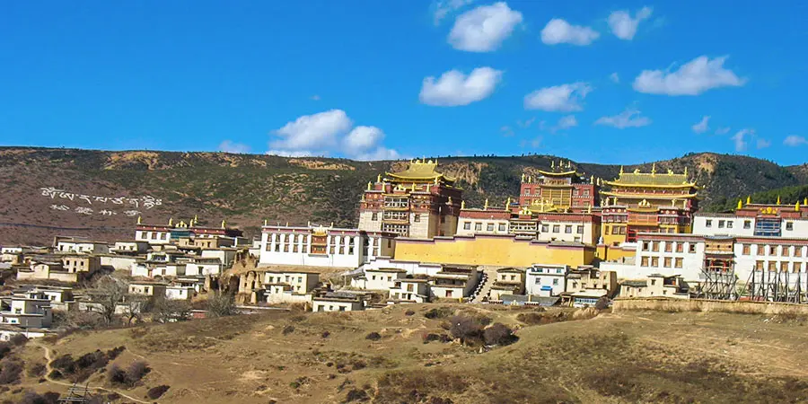 |
| Songzanlin Monastery |
Tips
1. Shangri-La’s attractions are far from each other, so you need to plan ahead. It’s best to bring some food to prevent you from feeling hungry during your visit.
2. If you want to taste Tibetan food, yak hot pot and butter tea are recommended in the cold February.
7-Day Shangri-La Weather Forecast
loading......
- Last updated on Mar. 02, 2026 by Brenda Lian -